
Magnitude |
2 |
| Date & Time (UTC) | 2015-02-07 20:26:16.1 |
| Date & Time (Local) | 1393/11/18 23:56:16.1 |
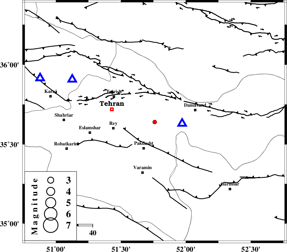
| Location | Lat:35.64 Lon: 51.76 |
| Region | Tehran Province, 19 km North of Pakdasht |
Nearest Cities |
|
| 15 km West of Rudehen, Tehran Province | |
| 15 km South West of Bumehen, Tehran Province | |
| 20 km North of Pakdasht, Tehran Province | |
| 20 km South of Lavasan, Tehran Province | |
| 23 km West of Ab sard, Tehran Province | |
| Depth | 15 km |
| Agency | |
Faults within 150 km: |
|
| EYVANEKEY_F (Length: 74 km) , Distance to epicenter: 17 km | |
| MOSHA_F (Length: 234 km) , Distance to epicenter: 19 km | |
| N_TEHRAN_F4 (Length: 115 km) , Distance to epicenter: 21 km | |
| Number of Phases | 3 |
| RMS | 0 |
| Number of Stations | 3 |
| Error in Latitude | >2.3 km |
| Error in Longitude | 1.9 km |
| Error in Depth | 0 km |
Download waveform in seisan format
to download seisan software Click here
to access information about IIEES stations Click here
Amplitude | ||||||||
| UID | Agency | Station | Component | Amplitude | Period | Arrival Time | Proccessing Time | Signal Clip |
| 94986 | IIEES | DAMV | E | 308.3 | 0.12 | 2015-02-07 20:26:23 | 2015-02-08 03:26:00 | n |
Phase | ||||||||||||
| Agency | Station | Component | Phase Type | Phase Quality | First Motion | Observed Arrival Time | Time Residual | Loc. Flag | Input Weight | Distance | Azimuth | |
| IIEES | DAMV | Z | Pg | E | 2015-02-07 20:26:20 | 0 | y | 19.3 | 92 | |||
| IIEES | CHTH | Z | Pg | E | 2015-02-07 20:26:27 | 0 | y | 64.7 | 298 | |||
| IIEES | GHVR | Z | Pn | E | 2015-02-07 20:26:40 | 0 | y | 136 | 200 | |||