
Magnitude |
2.5 |
| Date & Time (UTC) | 2015-02-19 10:07:27.8 |
| Date & Time (Local) | 1393/11/30 13:37:27.8 |
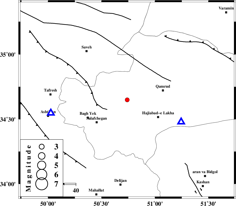
| Location | Lat:34.65 Lon: 50.74 |
| Region | Qom Province, 11 km West of Qom |
Nearest Cities |
|
| 12 km West of Qom, Qom Province | |
| 24 km South East of Gazran, Qom Province | |
| 30 km North West of Hajiabad-e lakha, Qom Province | |
| 32 km West of Qamrud, Qom Province | |
| 32 km North East of Salafchegan, Qom Province | |
| Depth | 29 km |
| Agency | |
Faults within 150 km: |
|
| INDES_F (Length: 98 km) , Distance to epicenter: 19 km | |
| KUSHK_E_NOSRAT_F (Length: 230 km) , Distance to epicenter: 33 km | |
| SIAHKUH_F (Length: 154 km) , Distance to epicenter: 65 km | |
| Number of Phases | 7 |
| RMS | 0.4 |
| Number of Stations | 5 |
| Error in Latitude | >5.8 km |
| Error in Longitude | 3 km |
| Error in Depth | 5.4 km |
Download waveform in seisan format
to download seisan software Click here
to access information about IIEES stations Click here
Amplitude | ||||||||
| UID | Agency | Station | Component | Amplitude | Period | Arrival Time | Proccessing Time | Signal Clip |
| 95067 | IIEES | GHVR | E | 351.8 | 0.48 | 2015-02-19 10:07:53 | 2015-02-19 10:36:00 | n |
| 95068 | IIEES | GHVR | N | 272.2 | 0.6 | 2015-02-19 10:07:54 | 2015-02-19 10:36:00 | n |
Phase | ||||||||||||
| Agency | Station | Component | Phase Type | Phase Quality | First Motion | Observed Arrival Time | Time Residual | Loc. Flag | Input Weight | Distance | Azimuth | |
| IIEES | GHVR | Z | Pg | E | 2015-02-19 10:07:36 | -0.64 | y | 49.7 | 112 | |||
| IIEES | GHVR | N | Sg | E | 2015-02-19 10:07:44 | 0.39 | y | 49.7 | 112 | |||
| IIEES | ASAO | Z | Pg | E | 2015-02-19 10:07:39 | -0.17 | y | 66.8 | 261 | |||
| IIEES | ASAO | N | Sg | E | 2015-02-19 10:07:49 | 0.25 | y | 66.8 | 261 | |||
| IIEES | KHMZ | Z | Pn | E | 2015-02-19 10:07:49 | -0.02 | y | 124 | 216 | |||
| IIEES | CHTH | Z | Pn | E | 2015-02-19 10:07:51 | -0.29 | y | 144 | 14 | |||
| IIEES | DAMV | Z | Pn | E | 2015-02-19 10:07:54 | 0.47 | y | 156 | 45 | |||