
Magnitude |
4.7 |
| Date & Time (UTC) | 2015-03-12 00:42:35.5 |
| Date & Time (Local) | 1393/12/21 04:12:35.5 |
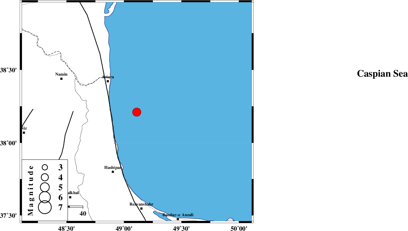
| Location | Lat:38.21 Lon: 49.11 |
| Region | Caspian Sea, 32 km South-East of Astara |
Nearest Cities |
|
| 21 km North East of Hariq, Gilan Province | |
| 25 km South East of Londovil, Gilan Province | |
| 30 km North East of Lisar, Gilan Province | |
| 32 km South East of Astara, Gilan Province | |
| 43 km North East of Chelonasr, Gilan Province | |
| Depth | 14 km |
| Agency | |
Faults within 150 km: |
|
| TALESH_F (Length: 258 km) , Distance to epicenter: 24 km | |
| SANGAVAR_F (Length: 61 km) , Distance to epicenter: 48 km | |
| BOZQUSH (Length: 70 km) , Distance to epicenter: 79 km | |
| Number of Phases | 6 |
| RMS | 0.1 |
| Number of Stations | 6 |
| Error in Latitude | >6.7 km |
| Error in Longitude | 7.3 km |
| Error in Depth | 11.3 km |
Download waveform in seisan format
to download seisan software Click here
to access information about IIEES stations Click here
Amplitude | ||||||||
| UID | Agency | Station | Component | Amplitude | Period | Arrival Time | Proccessing Time | Signal Clip |
| 95215 | IIEES | THKV | N | 2777.7 | 0.56 | 2015-03-12 00:44:01 | 2015-03-12 03:59:00 | n |
Phase | ||||||||||||
| Agency | Station | Component | Phase Type | Phase Quality | First Motion | Observed Arrival Time | Time Residual | Loc. Flag | Input Weight | Distance | Azimuth | |
| IIEES | ZNJK | Z | P | E | 2015-03-12 00:43:04 | -0.03 | y | 175 | 193 | |||
| IIEES | ZNJK | N | Sg | E | 2015-03-12 00:43:25 | 0.01 | y | 175 | 193 | |||
| IIEES | CHTH | Z | Pn | E | 2015-03-12 00:43:22 | -0.07 | y | 312 | 144 | |||
| IIEES | DAMV | Z | Pn | E | 2015-03-12 00:43:31 | 0.09 | y | 383 | 137 | |||
| IIEES | ASAO | Z | Pn | E | 2015-03-12 00:43:34 | -0.08 | y | 414 | 168 | |||
| IIEES | SHGR | Z | Pn | E | 2015-03-12 00:44:07 | 0.15 | y | 677 | 182 | |||

 IIEES All Rights Reserved