
Magnitude |
3.3 |
| Date & Time (UTC) | 2015-04-04 23:36:29.6 |
| Date & Time (Local) | 1394/1/16 04:06:29.6 |
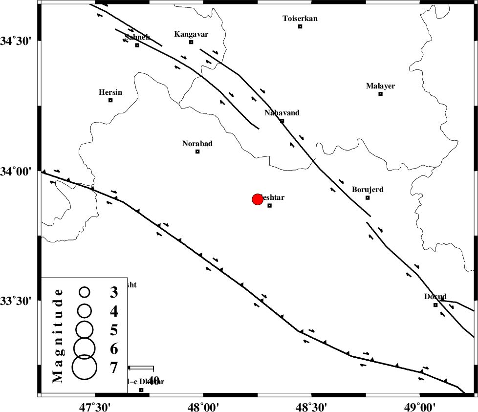
| Location | Lat:33.89 Lon: 48.25 |
| Region | Lorestan Province, 5 km Aleshtar |
Nearest Cities |
|
| 3 km North of Dehrahim, Lorestan Province | |
| 6 km North of Aleshtar, Lorestan Province | |
| 10 km East of Firuz Abad, Lorestan Province | |
| 11 km North of Siyahpush, Lorestan Province | |
| 24 km East of Farhadabad, Lorestan Province | |
| Depth | 14 km |
| Agency | |
Faults within 150 km: |
|
| NAHAVAND_F (Length: 102 km) , Distance to epicenter: 29 km | |
| SAHANEH_F (Length: 77 km) , Distance to epicenter: 30 km | |
| HZF4 (Length: 492 km) , Distance to epicenter: 37 km | |
| Number of Phases | 4 |
| RMS | 0 |
| Number of Stations | 3 |
| Error in Latitude | >5.4 km |
| Error in Longitude | 7.4 km |
| Error in Depth | 8.4 km |
Download waveform in seisan format
to download seisan software Click here
to access information about IIEES stations Click here
Amplitude | ||||||||
| UID | Agency | Station | Component | Amplitude | Period | Arrival Time | Proccessing Time | Signal Clip |
| 95325 | IIEES | ASAO | N | 467.4 | 0.64 | 2015-04-04 23:37:31 | 2015-04-05 12:01:00 | n |
| 95326 | IIEES | SHGR | E | 237.3 | 0.68 | 2015-04-04 23:37:33 | 2015-04-05 12:01:00 | n |
Phase | ||||||||||||
| Agency | Station | Component | Phase Type | Phase Quality | First Motion | Observed Arrival Time | Time Residual | Loc. Flag | Input Weight | Distance | Azimuth | |
| IIEES | KHMZ | Z | Pg | E | 2015-04-04 23:36:56 | -0.06 | y | 159 | 95 | |||
| IIEES | ASAO | Z | Pg | E | 2015-04-04 23:36:59 | -0.03 | y | 179 | 65 | |||
| IIEES | ASAO | N | Sg | E | 2015-04-04 23:37:21 | 0.05 | y | 179 | 65 | |||
| IIEES | SHGR | Z | Pn | E | 2015-04-04 23:37:02 | 0.04 | y | 204 | 165 | |||