
Magnitude |
2.9 |
| Date & Time (UTC) | 2015-04-11 16:08:26.6 |
| Date & Time (Local) | 1394/1/22 20:38:26.6 |
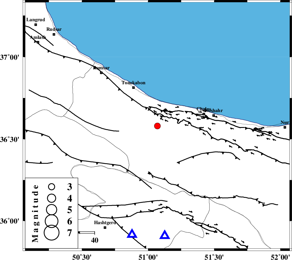
| Location | Lat:36.58 Lon: 51.07 |
| Region | Mazandaran Province, 31 km South-East of Tonekabon |
Nearest Cities |
|
| 15 km North West of Kardichal, Mazandaran Province | |
| 16 km South of Abbasabad, Mazandaran Province | |
| 19 km South West of Tazehabad, Mazandaran Province | |
| 19 km South of Kanza, Mazandaran Province | |
| 19 km South West of Kelarabad, Mazandaran Province | |
| Depth | 14 km |
| Agency | |
Faults within 150 km: |
|
| N_ALBORZ_F (Length: 360 km) , Distance to epicenter: 9 km | |
| KHAZAR_F (Length: 523 km) , Distance to epicenter: 13 km | |
| BONAN_F (Length: 74 km) , Distance to epicenter: 26 km | |
| Number of Phases | 5 |
| RMS | 0.1 |
| Number of Stations | 5 |
| Error in Latitude | >4.2 km |
| Error in Longitude | 3.9 km |
| Error in Depth | 4.5 km |
Download waveform in seisan format
to download seisan software Click here
to access information about IIEES stations Click here
Amplitude | ||||||||
| UID | Agency | Station | Component | Amplitude | Period | Arrival Time | Proccessing Time | Signal Clip |
| 95411 | IIEES | CHTH | E | 565.8 | 0.16 | 2015-04-11 16:08:48 | 2015-04-11 04:34:00 | n |
| 95412 | IIEES | ZNJK | N | 81.8 | 0.28 | 2015-04-11 16:09:28 | 2015-04-11 04:34:00 | n |
Phase | ||||||||||||
| Agency | Station | Component | Phase Type | Phase Quality | First Motion | Observed Arrival Time | Time Residual | Loc. Flag | Input Weight | Distance | Azimuth | |
| IIEES | CHTH | Z | Pg | E | 2015-04-11 16:08:39 | 0.11 | y | 74.2 | 176 | |||
| IIEES | THKV | Z | Pg | E | 2015-04-11 16:08:39 | -0.15 | y | 75.1 | 193 | |||
| IIEES | DAMV | Z | Pg | E | 2015-04-11 16:08:48 | -0.04 | y | 133 | 142 | |||
| IIEES | ZNJK | Z | Pg | E | 2015-04-11 16:09:01 | -0.01 | y | 213 | 274 | |||
| IIEES | ASAO | Z | Pn | E | 2015-04-11 16:09:04 | 0.09 | y | 244 | 203 | |||