
Magnitude |
2.9 |
| Date & Time (UTC) | 2015-04-15 02:02:57.9 |
| Date & Time (Local) | 1394/1/26 06:32:57.9 |
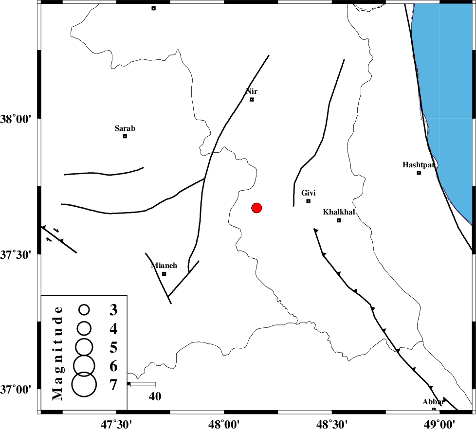
| Location | Lat:37.67 Lon: 48.15 |
| Region | Ardebil Province, 21 km West of Givi |
Nearest Cities |
|
| 11 km North of Firuz Abad, Ardebil Province | |
| 11 km West of Ganjgah, Ardebil Province | |
| 16 km South East of Armodaq, Azarbaijan Sharghi Province | |
| 21 km West of Givi, Ardebil Province | |
| 23 km North West of Gazaz, Ardebil Province | |
| Depth | 14 km |
| Agency | |
Faults within 150 km: |
|
| SANGAVAR_F (Length: 61 km) , Distance to epicenter: 15 km | |
| BOZQUSH (Length: 70 km) , Distance to epicenter: 24 km | |
| MASULEL_F (Length: 90 km) , Distance to epicenter: 25 km | |
| Number of Phases | 5 |
| RMS | 0.1 |
| Number of Stations | 5 |
| Error in Latitude | >4.8 km |
| Error in Longitude | 5.2 km |
| Error in Depth | 6.4 km |
Download waveform in seisan format
to download seisan software Click here
to access information about IIEES stations Click here
Amplitude | ||||||||
| UID | Agency | Station | Component | Amplitude | Period | Arrival Time | Proccessing Time | Signal Clip |
| 95432 | IIEES | THKV | N | 45 | 0.68 | 2015-04-15 02:04:26 | 2015-04-15 02:21:00 | n |
Phase | ||||||||||||
| Agency | Station | Component | Phase Type | Phase Quality | First Motion | Observed Arrival Time | Time Residual | Loc. Flag | Input Weight | Distance | Azimuth | |
| IIEES | ZNJK | Z | Pg | E | 2015-04-15 02:03:18 | 0.03 | y | 121 | 157 | |||
| IIEES | ZNJK | E | Sg | E | 2015-04-15 02:03:33 | -0.03 | y | 121 | 157 | |||
| IIEES | SNGE | Z | Pn | E | 2015-04-15 02:03:42 | -0.07 | y | 295 | 194 | |||
| IIEES | CHTH | Z | Pn | E | 2015-04-15 02:03:46 | -0.11 | y | 330 | 126 | |||
| IIEES | ASAO | Z | Pn | E | 2015-04-15 02:03:53 | 0.2 | y | 385 | 154 | |||