
Magnitude |
3.3 |
| Date & Time (UTC) | 2015-04-16 01:10:35.2 |
| Date & Time (Local) | 1394/1/27 05:40:35.2 |
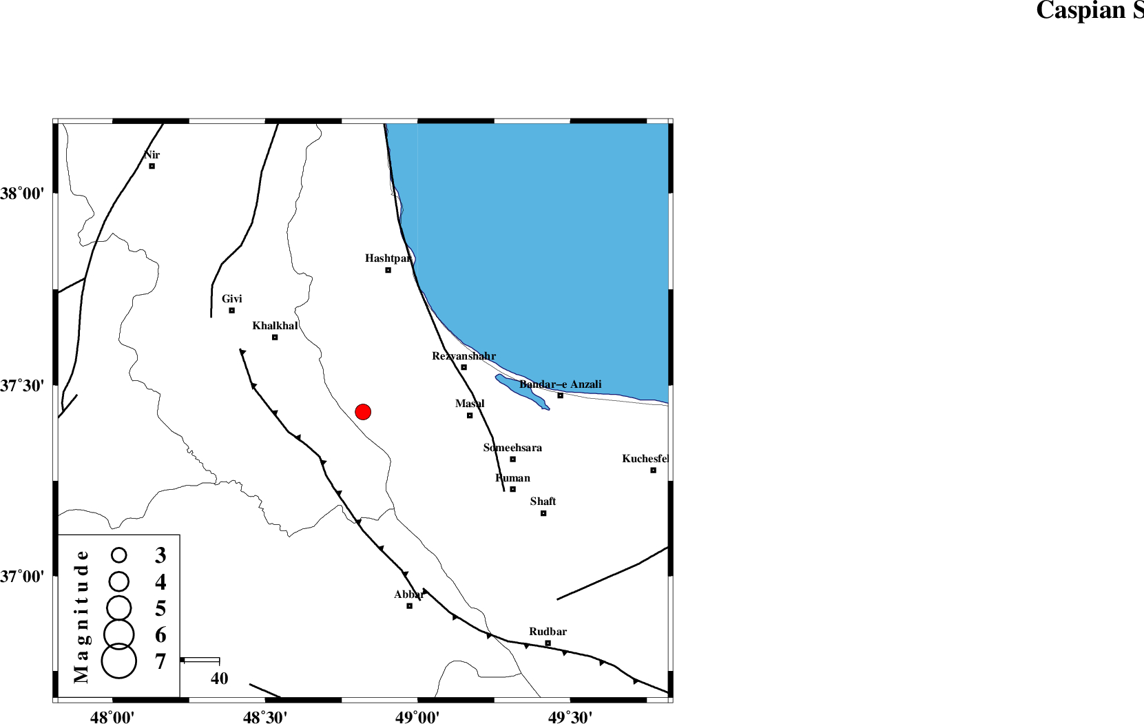
| Location | Lat:37.43 Lon: 48.82 |
| Region | Gilan Province, 31 km West of Masal |
Nearest Cities |
|
| 10 km North East of Kalur, Ardebil Province | |
| 11 km North of Shal, Ardebil Province | |
| 14 km South of Ardeh, Gilan Province | |
| 19 km North East of Karin, Ardebil Province | |
| 26 km West of Shangavar, Gilan Province | |
| Depth | 14 km |
| Agency | |
Faults within 150 km: |
|
| MASULEL_F (Length: 90 km) , Distance to epicenter: 18 km | |
| TALESH_F (Length: 258 km) , Distance to epicenter: 30 km | |
| SANGAVAR_F (Length: 61 km) , Distance to epicenter: 52 km | |
| Number of Phases | 6 |
| RMS | 0.1 |
| Number of Stations | 4 |
| Error in Latitude | >4.1 km |
| Error in Longitude | 2.4 km |
| Error in Depth | 5.3 km |
Download waveform in seisan format
to download seisan software Click here
to access information about IIEES stations Click here
Amplitude | ||||||||
| UID | Agency | Station | Component | Amplitude | Period | Arrival Time | Proccessing Time | Signal Clip |
| 95438 | IIEES | THKV | N | 173.3 | 0.52 | 2015-04-16 01:11:47 | 2015-04-16 03:53:00 | n |
Phase | ||||||||||||
| Agency | Station | Component | Phase Type | Phase Quality | First Motion | Observed Arrival Time | Time Residual | Loc. Flag | Input Weight | Distance | Azimuth | |
| IIEES | ZNJK | Z | Pg | E | 2015-04-16 01:10:49 | -0.05 | y | 85.2 | 188 | |||
| IIEES | ZNJK | E | Sg | E | 2015-04-16 01:11:00 | 0.01 | y | 85.2 | 188 | |||
| IIEES | THKV | Z | Pn | E | 2015-04-16 01:11:14 | 0.07 | y | 250 | 132 | |||
| IIEES | THKV | N | Sg | E | 2015-04-16 01:11:45 | 0.01 | y | 250 | 132 | |||
| IIEES | CHTH | Z | Pn | E | 2015-04-16 01:11:16 | -0.13 | y | 267 | 129 | |||
| IIEES | ASAO | Z | Pn | E | 2015-04-16 01:11:25 | 0.09 | y | 338 | 161 | |||