
Magnitude |
2.4 |
| Date & Time (UTC) | 2015-04-21 08:47:52.4 |
| Date & Time (Local) | 1394/2/1 13:17:52.4 |
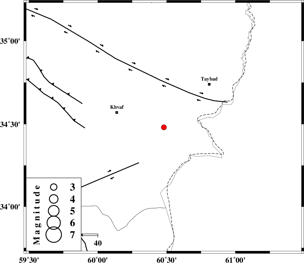
| Location | Lat:34.48 Lon: 60.48 |
| Region | Khorasan(center) Province, 33 km East of Khaf |
Nearest Cities |
|
| 13 km of Karat, Khorasan(center) Province | |
| 22 km North East of Sangan, Khorasan(center) Province | |
| 27 km East of Kharkord, Khorasan(center) Province | |
| 33 km East of Khaf, Khorasan(center) Province | |
| 35 km South of Mashhad rizeh, Khorasan(center) Province | |
| Depth | 17 km |
| Agency | |
Faults within 150 km: |
|
| DORUNEH_F (Length: 713 km) , Distance to epicenter: 29 km | |
| DASHT_E_BAYAZ_F (Length: 177 km) , Distance to epicenter: 29 km | |
| JANGAL_F (Length: 111 km) , Distance to epicenter: 53 km | |
| Number of Phases | 4 |
| RMS | 0 |
| Number of Stations | 3 |
| Error in Latitude | >3.9 km |
| Error in Longitude | 9.9 km |
| Error in Depth | 6.1 km |
Download waveform in seisan format
to download seisan software Click here
to access information about IIEES stations Click here
Amplitude | ||||||||
| UID | Agency | Station | Component | Amplitude | Period | Arrival Time | Proccessing Time | Signal Clip |
| 95491 | IIEES | YZKH | E | 1.8 | 0.48 | 2015-04-21 08:51:10 | 2015-04-21 09:58:00 | n |
Phase | ||||||||||||
| Agency | Station | Component | Phase Type | Phase Quality | First Motion | Observed Arrival Time | Time Residual | Loc. Flag | Input Weight | Distance | Azimuth | |
| IIEES | SHRT | Z | Pg | E | 2015-04-21 08:48:08 | 0 | y | 93.8 | 191 | |||
| IIEES | SHRT | E | Sg | E | 2015-04-21 08:48:20 | -0.01 | y | 93.8 | 191 | |||
| IIEES | BSRN | Z | Pn | E | 2015-04-21 08:48:37 | 0 | y | 306 | 205 | |||
| IIEES | YZKH | Z | Pn | E | 2015-04-21 08:49:13 | 0.01 | y | 594 | 249 | |||

 IIEES All Rights Reserved