
Magnitude |
1.9 |
| Date & Time (UTC) | 2015-04-24 03:24:00.5 |
| Date & Time (Local) | 1394/2/4 07:54:00.5 |
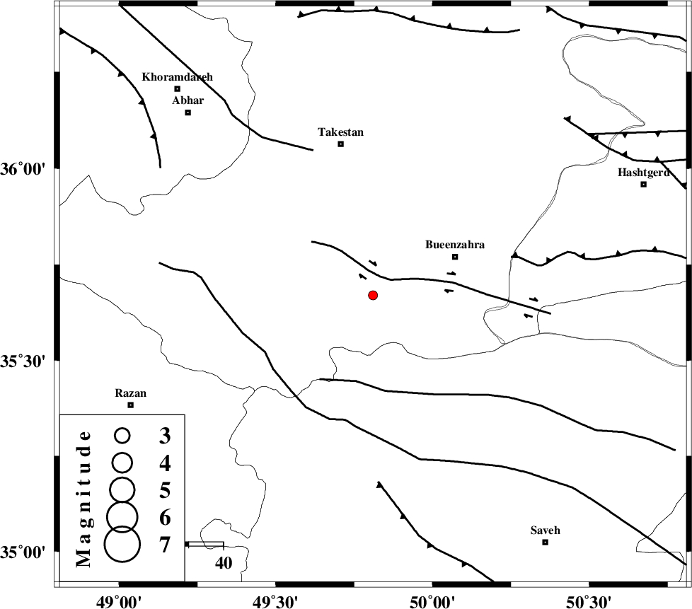
| Location | Lat:35.67 Lon: 49.81 |
| Region | Ghazvin Province, 26 km South-West of Buinzara |
Nearest Cities |
|
| 14 km South of Danesfahan, Ghazvin Province | |
| 16 km West of Sagezabad, Ghazvin Province | |
| 25 km South of Shal, Ghazvin Province | |
| 26 km South West of Buinzara, Ghazvin Province | |
| 30 km South of Esfarvin, Ghazvin Province | |
| Depth | 14 km |
| Agency | |
Faults within 150 km: |
|
| IPAK_F (Length: 80 km) , Distance to epicenter: 6 km | |
| S_PARANDAK_F (Length: 116 km) , Distance to epicenter: 25 km | |
| KUSHK_E_NOSRAT_F (Length: 230 km) , Distance to epicenter: 35 km | |
| Number of Phases | 5 |
| RMS | 0 |
| Number of Stations | 5 |
| Error in Latitude | >1.1 km |
| Error in Longitude | 2.2 km |
| Error in Depth | 4.1 km |
Download waveform in seisan format
to download seisan software Click here
to access information about IIEES stations Click here
Amplitude | ||||||||
| UID | Agency | Station | Component | Amplitude | Period | Arrival Time | Proccessing Time | Signal Clip |
| 95511 | IIEES | THKV | N | 38.8 | 0.16 | 2015-04-24 03:24:31 | 2015-04-24 03:48:00 | n |
| 95512 | IIEES | ZNJK | E | 22.8 | 0.32 | 2015-04-24 03:24:45 | 2015-04-24 03:48:00 | n |
| 95513 | IIEES | ZNJK | N | 19.2 | 0.16 | 2015-04-24 03:24:45 | 2015-04-24 03:48:00 | n |
Phase | ||||||||||||
| Agency | Station | Component | Phase Type | Phase Quality | First Motion | Observed Arrival Time | Time Residual | Loc. Flag | Input Weight | Distance | Azimuth | |
| IIEES | CHTH | Z | Pg | E | 2015-04-24 03:24:21 | -0.03 | y | 122 | 77 | |||
| IIEES | ASAO | Z | Pg | E | 2015-04-24 03:24:21 | 0.03 | y | 126 | 171 | |||
| IIEES | ASAO | E | Sg | E | 2015-04-24 03:24:37 | -0.03 | y | 126 | 171 | |||
| IIEES | ZNJK | Z | Pg | E | 2015-04-24 03:24:25 | -0.01 | y | 151 | 318 | |||
| IIEES | DAMV | Z | Pn | E | 2015-04-24 03:24:32 | 0.03 | y | 196 | 91 | |||