
Magnitude |
2.7 |
| Date & Time (UTC) | 2015-05-03 08:31:06.3 |
| Date & Time (Local) | 1394/2/13 13:01:06.3 |
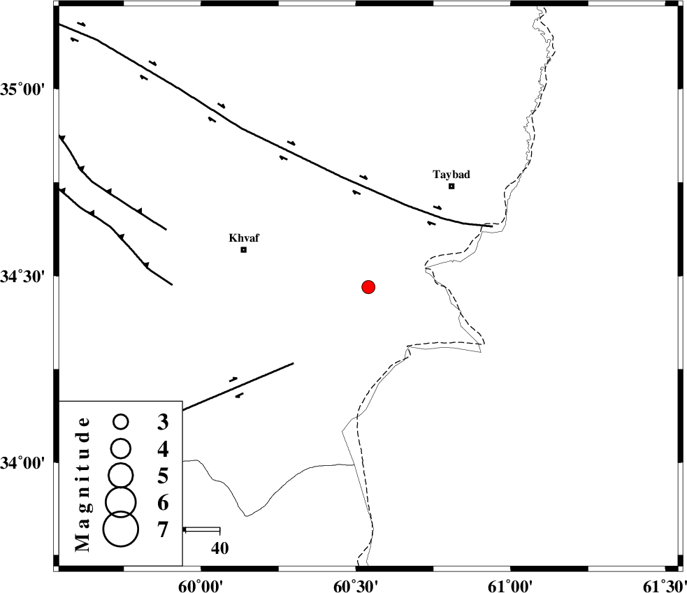
| Location | Lat:34.47 Lon: 60.54 |
| Region | Khorasan(center) Province, 38 km East of Khaf |
Nearest Cities |
|
| 11 km of Karat, Khorasan(center) Province | |
| 26 km North East of Sangan, Khorasan(center) Province | |
| 33 km East of Kharkord, Khorasan(center) Province | |
| 36 km South of Mashhad rizeh, Khorasan(center) Province | |
| 38 km North East of Niyazabad, Khorasan(center) Province | |
| Depth | 15 km |
| Agency | |
Faults within 150 km: |
|
| DORUNEH_F (Length: 713 km) , Distance to epicenter: 27 km | |
| DASHT_E_BAYAZ_F (Length: 177 km) , Distance to epicenter: 32 km | |
| JANGAL_F (Length: 111 km) , Distance to epicenter: 58 km | |
| Number of Phases | 6 |
| RMS | 0.2 |
| Number of Stations | 4 |
| Error in Latitude | >5.6 km |
| Error in Longitude | 7.2 km |
| Error in Depth | 8.2 km |
Download waveform in seisan format
to download seisan software Click here
to access information about IIEES stations Click here
Amplitude | ||||||||
| UID | Agency | Station | Component | Amplitude | Period | Arrival Time | Proccessing Time | Signal Clip |
| 95556 | IIEES | SHRT | N | 66.5 | 0.22 | 2015-05-03 08:31:35 | 2015-05-03 10:40:00 | n |
| 95557 | IIEES | KRBR | N | 7.3 | 0.22 | 2015-05-03 08:34:29 | 2015-05-03 10:40:00 | n |
| 95558 | IIEES | KRBR | E | 7.2 | 0.44 | 2015-05-03 08:34:33 | 2015-05-03 10:40:00 | n |
Phase | ||||||||||||
| Agency | Station | Component | Phase Type | Phase Quality | First Motion | Observed Arrival Time | Time Residual | Loc. Flag | Input Weight | Distance | Azimuth | |
| IIEES | SHRT | Z | Pg | E | 2015-05-03 08:31:22 | 0.07 | y | 94.2 | 194 | |||
| IIEES | SHRT | E | Sg | E | 2015-05-03 08:31:33 | -0.18 | y | 94.2 | 194 | |||
| IIEES | BSRN | Z | Pn | E | 2015-05-03 08:31:52 | 0.14 | y | 307 | 206 | |||
| IIEES | YZKH | Z | Pn | E | 2015-05-03 08:32:28 | -0.34 | y | 599 | 249 | |||
| IIEES | KRBR | Z | Pn | E | 2015-05-03 08:32:30 | 0.1 | y | 612 | 217 | |||
| IIEES | KRBR | E | Sg | E | 2015-05-03 08:33:56 | 0.24 | y | 612 | 217 | |||