
Magnitude |
1.9 |
| Date & Time (UTC) | 2015-05-04 18:17:02.8 |
| Date & Time (Local) | 1394/2/14 22:47:02.8 |
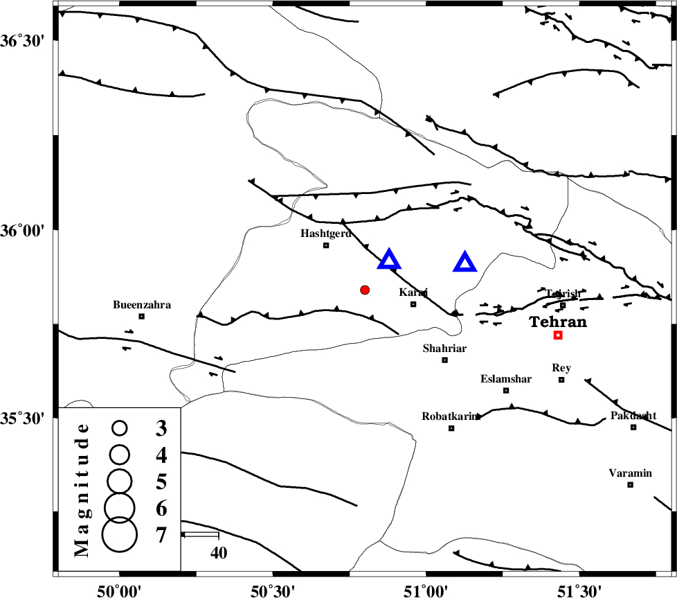
| Location | Lat:35.84 Lon: 50.8 |
| Region | Tehran Province, 15 km West of Karaj |
Nearest Cities |
|
| 12 km South of Chandar, Tehran Province | |
| 15 km North West of Karaj, Tehran Province | |
| 17 km North East of Palangabad, Tehran Province | |
| 17 km South East of Hashtgerd, Tehran Province | |
| 19 km West of Barghan, Tehran Province | |
| Depth | 25 km |
| Agency | |
Faults within 150 km: |
|
| ESHTEHARD_F (Length: 69 km) , Distance to epicenter: 8 km | |
| N_TEHRAN_F4 (Length: 115 km) , Distance to epicenter: 12 km | |
| MOSHA_F (Length: 234 km) , Distance to epicenter: 20 km | |
| Number of Phases | 5 |
| RMS | 0 |
| Number of Stations | 5 |
| Error in Latitude | >2.2 km |
| Error in Longitude | 1.8 km |
| Error in Depth | 4.3 km |
Download waveform in seisan format
to download seisan software Click here
to access information about IIEES stations Click here
Amplitude | ||||||||
| UID | Agency | Station | Component | Amplitude | Period | Arrival Time | Proccessing Time | Signal Clip |
| 95576 | IIEES | THKV | N | 233.9 | 0.12 | 2015-05-04 18:17:10 | 2015-05-05 03:22:00 | n |
Phase | ||||||||||||
| Agency | Station | Component | Phase Type | Phase Quality | First Motion | Observed Arrival Time | Time Residual | Loc. Flag | Input Weight | Distance | Azimuth | |
| IIEES | CHTH | Z | Pg | E | 2015-05-04 18:17:09 | 0.09 | y | 30 | 75 | |||
| IIEES | CHTH | E | Sg | E | 2015-05-04 18:17:14 | -0.05 | y | 30 | 75 | |||
| IIEES | DAMV | Z | Pg | E | 2015-05-04 18:17:21 | -0.03 | y | 108 | 102 | |||
| IIEES | ASAO | Z | Pg | E | 2015-05-04 18:17:28 | 0 | y | 160 | 207 | |||
| IIEES | ZNJK | E | Sg | E | 2015-05-04 18:18:01 | -0.01 | y | 212 | 296 | |||