
Magnitude |
1.9 |
| Date & Time (UTC) | 2015-06-24 18:23:18.5 |
| Date & Time (Local) | 1394/4/3 22:53:18.5 |
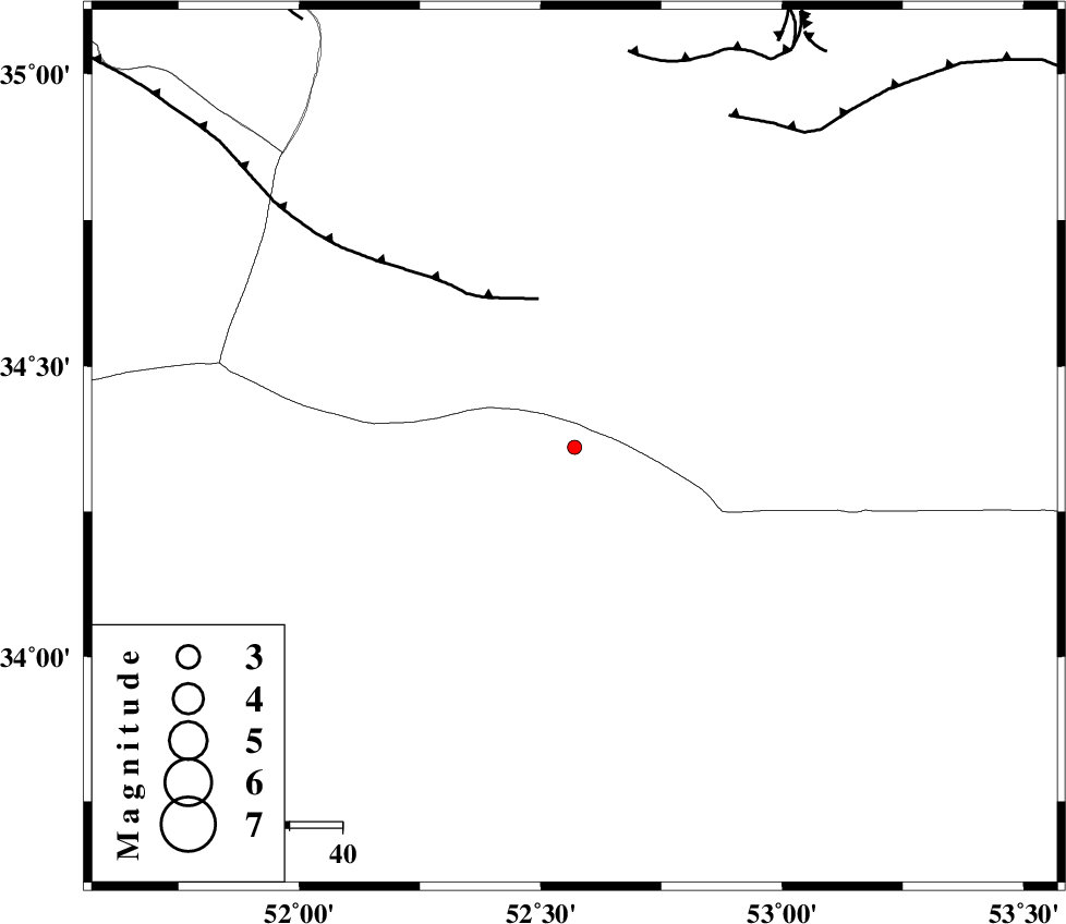
| Location | Lat:34.36 Lon: 52.57 |
| Region | Esfahan Province, 97 km South-East of Garmsar |
Nearest Cities |
|
| 65 km North East of Marnejab, Esfahan Province | |
| 85 km North East of Hoseynabad, Esfahan Province | |
| 88 km North East of Abuzeidabad, Esfahan Province | |
| 91 km South East of Gardovan, Semnan Province | |
| 94 km North East of Mughar, Esfahan Province | |
| Depth | 15 km |
| Agency | |
Faults within 150 km: |
|
| SIAHKUH_F (Length: 154 km) , Distance to epicenter: 30 km | |
| KUH_E_GUGERD_F (Length: 73 km) , Distance to epicenter: 70 km | |
| KUH_E_GACHAB_F1 (Length: 53 km) , Distance to epicenter: 76 km | |
| Number of Phases | 7 |
| RMS | 0.1 |
| Number of Stations | 4 |
| Error in Latitude | >1.5 km |
| Error in Longitude | 2.5 km |
| Error in Depth | 4 km |
Download waveform in seisan format
to download seisan software Click here
to access information about IIEES stations Click here
Amplitude | ||||||||
| UID | Agency | Station | Component | Amplitude | Period | Arrival Time | Proccessing Time | Signal Clip |
| 96041 | IIEES | NASN | N | 17.6 | 0.32 | 2015-06-24 18:24:12 | 2015-06-24 09:04:00 | n |
| 96042 | IIEES | NASN | E | 13.4 | 0.4 | 2015-06-24 18:24:13 | 2015-06-24 09:04:00 | n |
Phase | ||||||||||||
| Agency | Station | Component | Phase Type | Phase Quality | First Motion | Observed Arrival Time | Time Residual | Loc. Flag | Input Weight | Distance | Azimuth | |
| IIEES | GHVR | Z | Pg | E | 2015-06-24 18:23:39 | 0.11 | y | 122 | 277 | |||
| IIEES | GHVR | E | Sg | E | 2015-06-24 18:23:53 | -0.01 | y | 122 | 277 | |||
| IIEES | NASN | Z | Pg | E | 2015-06-24 18:23:47 | 0.11 | y | 175 | 172 | |||
| IIEES | NASN | E | Sg | E | 2015-06-24 18:24:08 | -0.14 | y | 175 | 172 | |||
| IIEES | CHTH | Z | Pn | E | 2015-06-24 18:23:53 | -0.04 | y | 216 | 323 | |||
| IIEES | CHTH | E | Sg | E | 2015-06-24 18:24:19 | -0.07 | y | 216 | 323 | |||
| IIEES | YZKH | Z | Pn | E | 2015-06-24 18:24:02 | 0.05 | y | 289 | 139 | |||