
Magnitude |
2.6 |
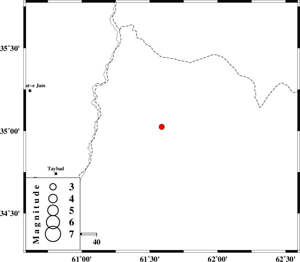
| Date & Time (UTC) | 2015-08-12 19:55:07.8 |
| Date & Time (Local) | 1394/5/22 00:25:07.8 |
| Location | Lat:35.024 Lon: 61.588 |
| Region | Afghanistan, 78 km North-East of Taybad |
Nearest Cities |
|
| 64 km South East of Samieabad, Khorasan(center) Province | |
| 74 km North East of Void, Khorasan(center) Province | |
| 76 km South East of Jannatabad, Khorasan(center) Province | |
| 78 km North East of Taybad, Khorasan(center) Province | |
| 90 km South East of Cheshmehgol, Khorasan(center) Province | |
| Depth | 14 km |
| Agency | |
Faults within 150 km: |
|
| DORUNEH_F (Length: 713 km) , Distance to epicenter: 73 km | |
| TORBAT_E_JAM_F2 (Length: 57 km) , Distance to epicenter: 111 km | |
| DASHT_E_BAYAZ_F (Length: 177 km) , Distance to epicenter: 145 km | |
| Number of Phases | 7 |
| RMS | 0.1 |
| Number of Stations | 6 |
| Error in Latitude | >2.6 km |
| Error in Longitude | 7.5 km |
| Error in Depth | 5.8 km |
Download waveform in seisan format
to download seisan software Click here
to access information about IIEES stations Click here
Amplitude | ||||||||
| UID | Agency | Station | Component | Amplitude | Period | Arrival Time | Proccessing Time | Signal Clip |
| 100329 | IIEES | TABS | N | 11.9 | 0.68 | 2015-08-12 19:57:05 | 2015-08-14 03:33:00 | n |
| 100330 | IIEES | TABS | E | 5 | 0.68 | 2015-08-12 19:57:06 | 2015-08-14 03:33:00 | n |
Phase | ||||||||||||
| Agency | Station | Component | Phase Type | Phase Quality | First Motion | Observed Arrival Time | Time Residual | Loc. Flag | Input Weight | Distance | Azimuth | |
| IIEES | SHRT | Z | Pg | E | 2015-08-12 19:55:39 | -0.17 | y | 194 | 218 | |||
| IIEES | SHRT | N | Sg | E | 2015-08-12 19:56:03 | 0.02 | y | 194 | 218 | |||
| IIEES | BSRN | Z | P | E | 2015-08-12 19:56:06 | 0.16 | y | 409 | 215 | |||
| IIEES | TABS | Z | Pn | E | 2015-08-12 19:56:10 | 0.06 | y | 438 | 251 | |||
| IIEES | BJRD | Z | Pn | E | 2015-08-12 19:56:14 | -0.14 | y | 478 | 310 | |||
| IIEES | SHRO | Z | Pn | E | 2015-08-12 19:56:19 | 0.02 | y | 517 | 284 | |||
| IIEES | MRVT | Z | Pn | E | 2015-08-12 19:56:26 | 0.12 | y | 574 | 302 | |||