
Magnitude |
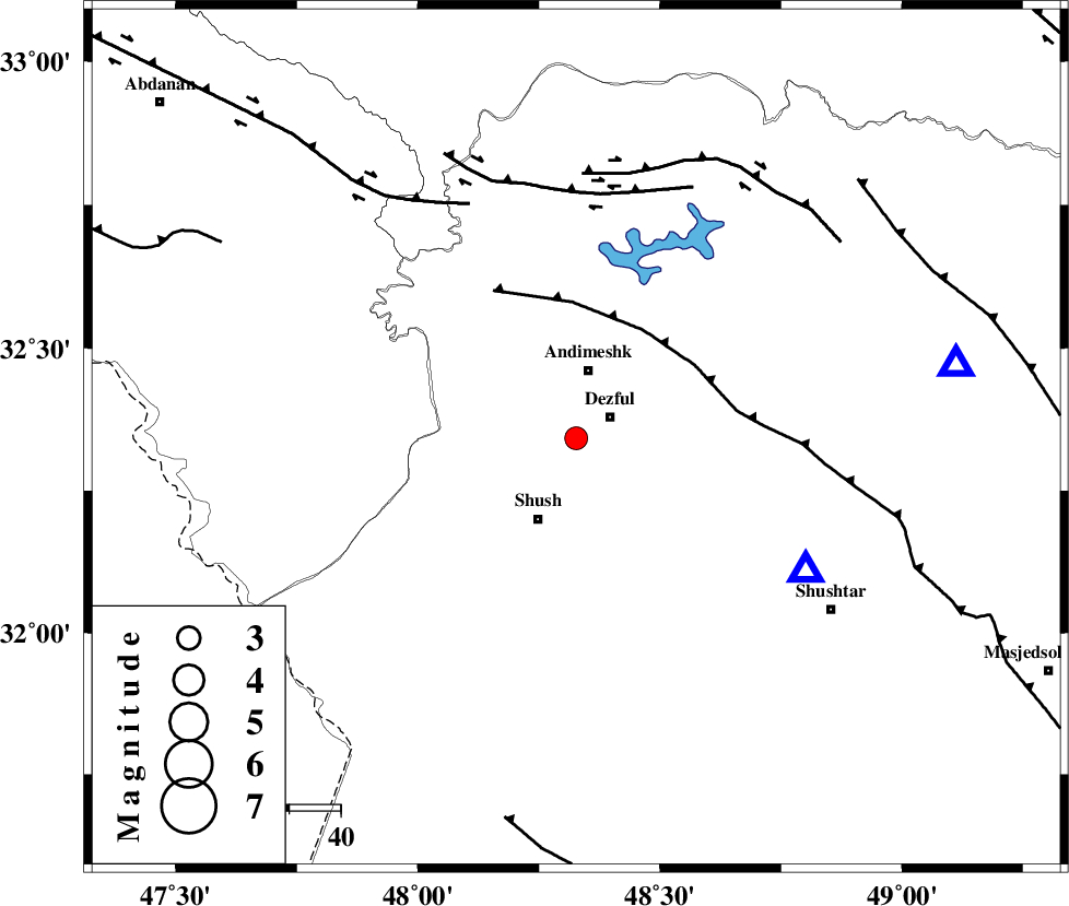
2.9 |
| Date & Time (UTC) | 2015-08-21 02:44:06.1 |
| Date & Time (Local) | 1394/5/30 07:14:06.1 |
| Location | Lat:32.342 Lon: 48.327 |
| Region | Khoozestan Province, 8 km of Dezful |
Nearest Cities |
|
| 8 km of Dezful, Khoozestan Province | |
| 11 km North West of Shamsabad, Khoozestan Province | |
| 13 km South of Andimeshk, Khoozestan Province | |
| 17 km North of Shush, Khoozestan Province | |
| 19 km North of Amaleh teimur, Khoozestan Province | |
| Depth | 15 km |
| Agency | |
Faults within 150 km: |
|
| DEZFUL_EMBAYMENT (Length: 228 km) , Distance to epicenter: 25 km | |
| BALARUD_F_Z3 (Length: 53 km) , Distance to epicenter: 48 km | |
| BALARUD_F_Z1 (Length: 87 km) , Distance to epicenter: 50 km | |
| Number of Phases | 6 |
| RMS | 0.2 |
| Number of Stations | 6 |
| Error in Latitude | >3.3 km |
| Error in Longitude | 4.3 km |
| Error in Depth | 0 km |
Download waveform in seisan format
to download seisan software Click here
to access information about IIEES stations Click here
Amplitude | ||||||||
| UID | Agency | Station | Component | Amplitude | Period | Arrival Time | Proccessing Time | Signal Clip |
| 100410 | IIEES | NASN | N | 19.8 | 0.28 | 2015-08-21 02:45:56 | 2015-08-22 07:12:00 | n |
Phase | ||||||||||||
| Agency | Station | Component | Phase Type | Phase Quality | First Motion | Observed Arrival Time | Time Residual | Loc. Flag | Input Weight | Distance | Azimuth | |
| IIEES | KHMZ | Z | Pn | E | 2015-08-21 02:44:41 | 0.22 | y | 218 | 44 | |||
| IIEES | GHVR | Z | Pn | E | 2015-08-21 02:44:58 | 0.07 | y | 360 | 48 | |||
| IIEES | NASN | Z | Pn | E | 2015-08-21 02:45:06 | -0.42 | y | 424 | 82 | |||
| IIEES | AHRM | Z | Pn | E | 2015-08-21 02:45:13 | 0.09 | y | 479 | 143 | |||
| IIEES | ZNJK | Z | Pn | E | 2015-08-21 02:45:13 | -0.16 | y | 481 | 4 | |||
| IIEES | YZKH | Z | Pn | E | 2015-08-21 02:45:27 | 0.15 | y | 590 | 88 | |||