
Magnitude |
3.5 |
| Date & Time (UTC) | 2015-08-23 18:44:12.3 |
| Date & Time (Local) | 1394/6/1 23:14:12.3 |
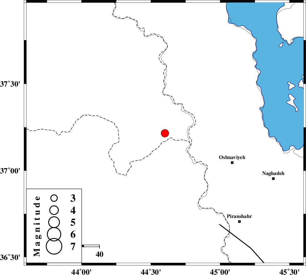
| Location | Lat:37.215 Lon: 44.601 |
| Region | Turkey, 47 km North-West of Oshnaviyeh |
Nearest Cities |
|
| 27 km West of Ziveh, Azarbaijan Gharbi Province | |
| 29 km South West of Razhan, Azarbaijan Gharbi Province | |
| 31 km South West of Silvaneh, Azarbaijan Gharbi Province | |
| 43 km South West of Movana, Azarbaijan Gharbi Province | |
| 45 km North West of Aghbelagh, Azarbaijan Gharbi Province | |
| Depth | 14 km |
| Agency | |
Faults within 150 km: |
|
| PIRANSHAHR_F (Length: 253 km) , Distance to epicenter: 68 km | |
| SALMAS (Length: 20 km) , Distance to epicenter: 95 km | |
| N_TABRIZ_F3 (Length: 66 km) , Distance to epicenter: 121 km | |
| Number of Phases | 6 |
| RMS | 0.1 |
| Number of Stations | 4 |
| Error in Latitude | >3.1 km |
| Error in Longitude | 6.5 km |
| Error in Depth | 9.7 km |
Download waveform in seisan format
to download seisan software Click here
to access information about IIEES stations Click here
Amplitude | ||||||||
| UID | Agency | Station | Component | Amplitude | Period | Arrival Time | Proccessing Time | Signal Clip |
| 100436 | IIEES | GRMI | N | 134.6 | 0.96 | 2015-08-23 18:46:02 | 2015-08-24 06:05:00 | n |
| 100437 | IIEES | ZNJK | N | 106.1 | 0.52 | 2015-08-23 18:46:08 | 2015-08-24 06:05:00 | n |
Phase | ||||||||||||
| Agency | Station | Component | Phase Type | Phase Quality | First Motion | Observed Arrival Time | Time Residual | Loc. Flag | Input Weight | Distance | Azimuth | |
| IIEES | MAKU | Z | Pn | E | 2015-08-23 18:44:49 | -0.06 | y | 238 | 2 | |||
| IIEES | GRMI | Z | Pn | E | 2015-08-23 18:45:02 | 0.09 | y | 339 | 58 | |||
| IIEES | GRMI | E | Sg | E | 2015-08-23 18:45:47 | 0 | y | 339 | 58 | |||
| IIEES | ZNJK | Z | Pn | E | 2015-08-23 18:45:05 | -0.04 | y | 369 | 98 | |||
| IIEES | ZNJK | N | Sg | E | 2015-08-23 18:45:55 | -0.04 | y | 369 | 98 | |||
| IIEES | CHTH | Z | Pn | E | 2015-08-23 18:45:35 | 0.08 | y | 602 | 102 | |||

 IIEES All Rights Reserved