
Magnitude |
3 |
| Date & Time (UTC) | 2015-10-15 04:04:09.6 |
| Date & Time (Local) | 1394/7/23 07:34:09.6 |
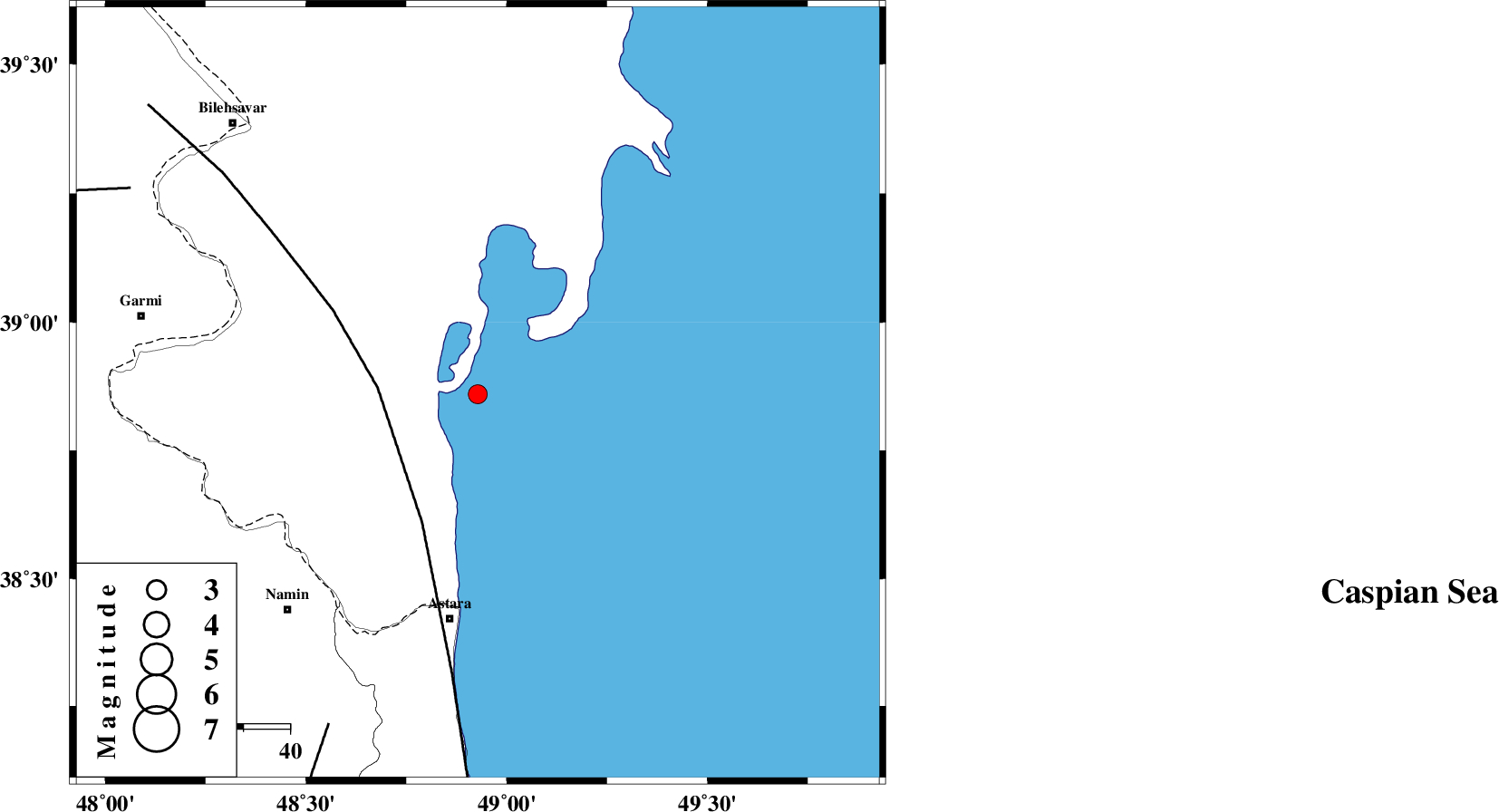
| Location | Lat:38.86 Lon: 48.928 |
| Region | Caspian Sea, 49 km North of Astara |
Nearest Cities |
|
| 49 km North of Astara, Gilan Province | |
| 57 km North East of Anbaran, Ardebil Province | |
| 58 km North East of Kiladeh, Gilan Province | |
| 60 km South East of Hasan khanlu, Ardebil Province | |
| 60 km North East of Lurun, Ardebil Province | |
| Depth | 15 km |
| Agency | |
Faults within 150 km: |
|
| TALESH_F (Length: 258 km) , Distance to epicenter: 22 km | |
| SANGAVAR_F (Length: 61 km) , Distance to epicenter: 79 km | |
| DASHT_E_MOGHAN__ (Length: 104 km) , Distance to epicenter: 87 km | |
| Number of Phases | 6 |
| RMS | 0.1 |
| Number of Stations | 6 |
| Error in Latitude | >3.4 km |
| Error in Longitude | 2.9 km |
| Error in Depth | 5.9 km |
Download waveform in seisan format
to download seisan software Click here
to access information about IIEES stations Click here
Amplitude | ||||||||
| UID | Agency | Station | Component | Amplitude | Period | Arrival Time | Proccessing Time | Signal Clip |
| 101788 | IIEES | GRMI | N | 581.5 | 0.22 | 2015-10-15 04:04:38 | 2015-10-17 10:47:00 | n |
| 101789 | IIEES | GRMI | E | 455.9 | 0.22 | 2015-10-15 04:04:39 | 2015-10-17 10:47:00 | n |
Phase | ||||||||||||
| Agency | Station | Component | Phase Type | Phase Quality | First Motion | Observed Arrival Time | Time Residual | Loc. Flag | Input Weight | Distance | Azimuth | |
| IIEES | GRMI | N | Sg | E | 2015-10-15 04:04:36 | -0.03 | y | 89.9 | 267 | |||
| IIEES | ZNJK | Z | Pn | E | 2015-10-15 04:04:47 | -0.09 | y | 244 | 185 | |||
| IIEES | MAKU | Z | Pn | E | 2015-10-15 04:05:03 | 0.08 | y | 371 | 280 | |||
| IIEES | CHTH | Z | Pn | E | 2015-10-15 04:05:04 | 0.17 | y | 381 | 149 | |||
| IIEES | MRVT | Z | Pn | E | 2015-10-15 04:05:36 | -0.13 | y | 641 | 100 | |||
| IIEES | BJRD | Z | Pn | E | 2015-10-15 04:05:50 | -0.05 | y | 753 | 97 | |||