
Magnitude |
2.6 |
| Date & Time (UTC) | 2015-12-17 23:35:06.7 |
| Date & Time (Local) | 1394/9/27 03:05:06.7 |
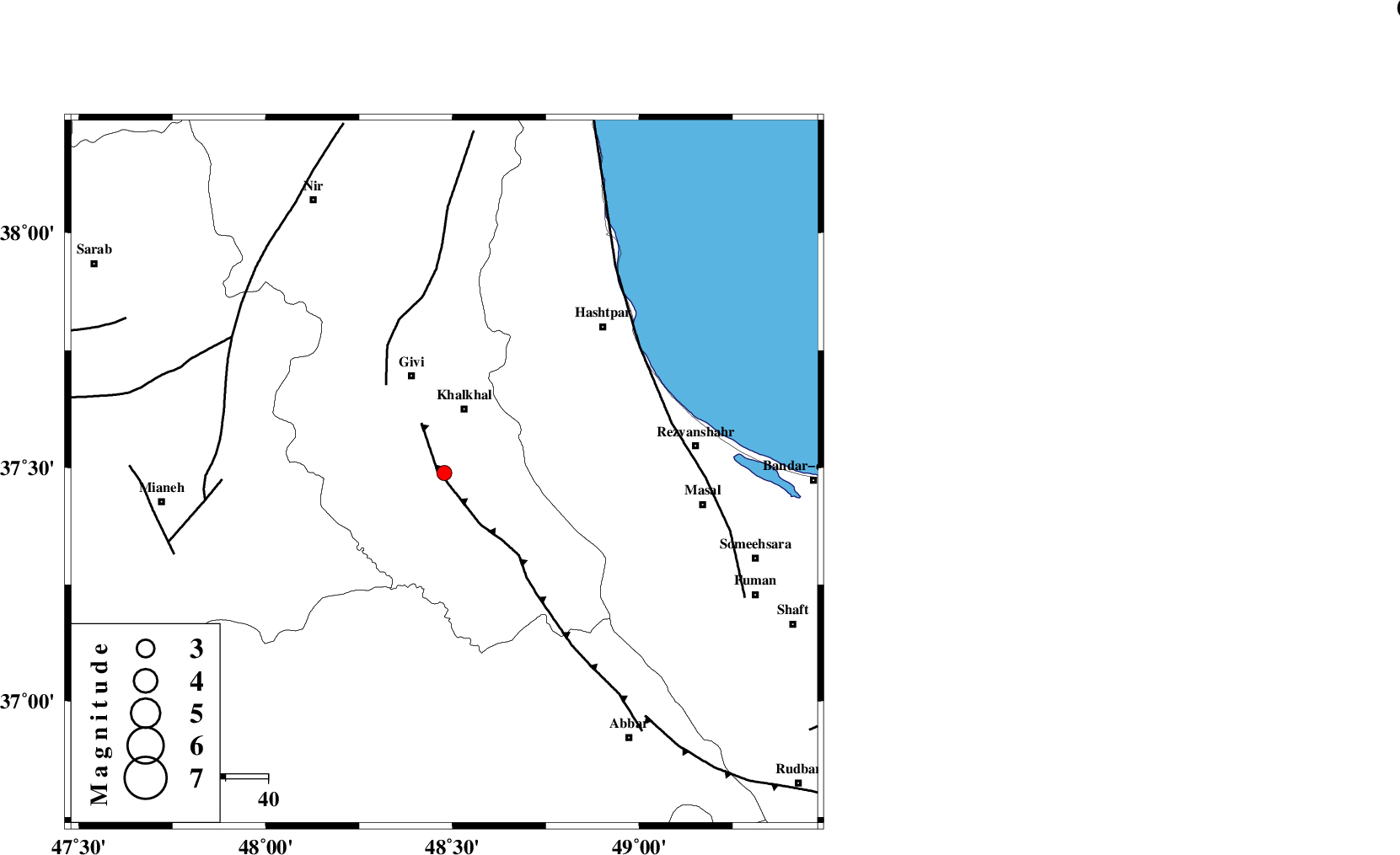
| Location | Lat:37.488 Lon: 48.478 |
| Region | Ardebil Province, 16 km South of Khalkhal |
Nearest Cities |
|
| 13 km of Gazaz, Ardebil Province | |
| 14 km South of Khojin, Ardebil Province | |
| 16 km South of Khalkhal, Ardebil Province | |
| 20 km North East of Hashtjin, Ardebil Province | |
| 24 km North West of Kalur, Ardebil Province | |
| Depth | 14 km |
| Agency | |
Faults within 150 km: |
|
| MASULEL_F (Length: 90 km) , Distance to epicenter: 2 km | |
| SANGAVAR_F (Length: 61 km) , Distance to epicenter: 25 km | |
| BOZQUSH (Length: 70 km) , Distance to epicenter: 53 km | |
| Number of Phases | 8 |
| RMS | 0.3 |
| Number of Stations | 5 |
| Error in Latitude | >2 km |
| Error in Longitude | 6.9 km |
| Error in Depth | 7.5 km |
Download waveform in seisan format
to download seisan software Click here
to access information about IIEES stations Click here
Amplitude | ||||||||
| UID | Agency | Station | Component | Amplitude | Period | Arrival Time | Proccessing Time | Signal Clip |
| 102876 | IIEES | GRMI | E | 73.1 | 0.17 | 2015-12-17 23:35:53 | 2015-12-19 07:43:00 | n |
| 102877 | IIEES | GRMI | N | 90.2 | 0.33 | 2015-12-17 23:35:53 | 2015-12-19 07:43:00 | n |
Phase | ||||||||||||
| Agency | Station | Component | Phase Type | Phase Quality | First Motion | Observed Arrival Time | Time Residual | Loc. Flag | Input Weight | Distance | Azimuth | |
| IIEES | ZNJK | Z | Pg | E | 2015-12-17 23:35:22 | -0.43 | y | 92.6 | 168 | |||
| IIEES | ZNJK | N | Sg | E | 2015-12-17 23:35:33 | -0.45 | y | 92.6 | 168 | |||
| IIEES | GRMI | Z | Pg | E | 2015-12-17 23:35:32 | -0.28 | y | 155 | 341 | |||
| IIEES | GRMI | N | Sg | E | 2015-12-17 23:35:51 | 0 | y | 155 | 341 | |||
| IIEES | SNGE | Z | Pn | E | 2015-12-17 23:35:50 | 0.23 | y | 285 | 201 | |||
| IIEES | SNGE | N | Sg | E | 2015-12-17 23:36:27 | 0.25 | y | 285 | 201 | |||
| IIEES | CHTH | Z | Pn | E | 2015-12-17 23:35:51 | 0.48 | y | 295 | 126 | |||
| IIEES | ASAO | Z | Pn | E | 2015-12-17 23:35:59 | 0.31 | y | 355 | 156 | |||

 IIEES All Rights Reserved