
Magnitude |
2.6 |
| Date & Time (UTC) | 2016-03-10 17:04:20.4 |
| Date & Time (Local) | 1394/12/20 20:34:20.4 |
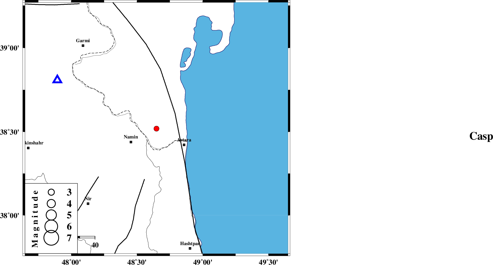
| Location | Lat:38.519 Lon: 48.648 |
| Region | Azerbaijan, 19 km -East of Namin |
Nearest Cities |
|
| 15 km North of Kiladeh, Gilan Province | |
| 16 km North East of Anbaran, Ardebil Province | |
| 19 km North East of Namin, Ardebil Province | |
| 20 km North East of Nanehkaran, Ardebil Province | |
| 21 km North West of Astara, Gilan Province | |
| Depth | 14 km |
| Agency | |
Faults within 150 km: |
|
| TALESH_F (Length: 258 km) , Distance to epicenter: 16 km | |
| SANGAVAR_F (Length: 61 km) , Distance to epicenter: 35 km | |
| BOZQUSH (Length: 70 km) , Distance to epicenter: 50 km | |
| Number of Phases | 5 |
| RMS | 0.2 |
| Number of Stations | 3 |
| Error in Latitude | >5 km |
| Error in Longitude | 9.9 km |
| Error in Depth | 7.1 km |
Download waveform in seisan format
to download seisan software Click here
to access information about IIEES stations Click here
Amplitude | ||||||||
| UID | Agency | Station | Component | Amplitude | Period | Arrival Time | Proccessing Time | Signal Clip |
| 104900 | IIEES | GRMI | N | 350.3 | 0.27 | 2016-03-10 17:04:42 | 2016-03-12 08:26:00 | n |
| 104901 | IIEES | GRMI | E | 335 | 0.15 | 2016-03-10 17:04:43 | 2016-03-12 08:26:00 | n |
Phase | ||||||||||||
| Agency | Station | Component | Phase Type | Phase Quality | First Motion | Observed Arrival Time | Time Residual | Loc. Flag | Input Weight | Distance | Azimuth | |
| IIEES | GRMI | Z | Pg | E | 2016-03-10 17:04:33 | 0.25 | y | 73.1 | 296 | |||
| IIEES | GRMI | N | Sg | E | 2016-03-10 17:04:42 | -0.15 | y | 73.1 | 296 | |||
| IIEES | ZNJK | Z | Pg | E | 2016-03-10 17:04:53 | -0.25 | y | 205 | 179 | |||
| IIEES | ZNJK | N | Sg | E | 2016-03-10 17:05:19 | 0.15 | y | 205 | 179 | |||
| IIEES | SNGE | Z | Pn | E | 2016-03-10 17:05:17 | 0 | y | 398 | 197 | |||