
Magnitude |
2.6 |
| Date & Time (UTC) | 2016-04-14 07:45:16.0 |
| Date & Time (Local) | 1395/1/26 12:15:16.0 |
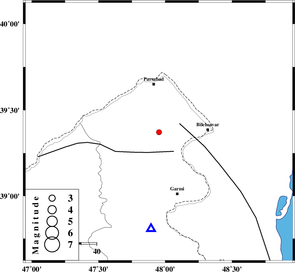
| Location | Lat:39.372 Lon: 47.953 |
| Region | Ardebil Province, 31 km South of Pars Abad |
Nearest Cities |
|
| 14 km South of Jaefarabad, Ardebil Province | |
| 17 km North West of Moradlu, Ardebil Province | |
| 20 km North West of Gorg tappeh, Ardebil Province | |
| 20 km North of Shurgol, Ardebil Province | |
| 21 km North West of Anjirlu, Ardebil Province | |
| Depth | 23 km |
| Agency | |
Faults within 150 km: |
|
| TALESH_F (Length: 258 km) , Distance to epicenter: 14 km | |
| DASHT_E_MOGHAN__ (Length: 104 km) , Distance to epicenter: 15 km | |
| BOZQUSH (Length: 70 km) , Distance to epicenter: 129 km | |
| Number of Phases | 6 |
| RMS | 0.2 |
| Number of Stations | 4 |
| Error in Latitude | >9.7 km |
| Error in Longitude | 9.9 km |
| Error in Depth | 8.6 km |
Download waveform in seisan format
to download seisan software Click here
to access information about IIEES stations Click here
Amplitude | ||||||||
| UID | Agency | Station | Component | Amplitude | Period | Arrival Time | Proccessing Time | Signal Clip |
| 105459 | IIEES | GRMI | E | 290.3 | 0.15 | 2016-04-14 07:45:41 | 2016-04-16 06:22:00 | n |
| 105460 | IIEES | GRMI | N | 371.2 | 0.28 | 2016-04-14 07:45:41 | 2016-04-16 06:22:00 | n |
| 105461 | IIEES | MAKU | N | 24.6 | 0.36 | 2016-04-14 07:46:35 | 2016-04-16 06:22:00 | n |
Phase | ||||||||||||
| Agency | Station | Component | Phase Type | Phase Quality | First Motion | Observed Arrival Time | Time Residual | Loc. Flag | Input Weight | Distance | Azimuth | |
| IIEES | GRMI | Z | Pg | E | 2016-04-14 07:45:27 | -0.01 | y | 62.6 | 185 | |||
| IIEES | MAKU | Z | Pn | E | 2016-04-14 07:45:58 | 0.34 | y | 282 | 271 | |||
| IIEES | MAKU | N | Sg | E | 2016-04-14 07:46:33 | -0.15 | y | 282 | 271 | |||
| IIEES | ZNJK | Z | Pn | E | 2016-04-14 07:46:00 | -0.33 | y | 307 | 168 | |||
| IIEES | ZNJK | E | Sg | E | 2016-04-14 07:46:40 | 0.17 | y | 307 | 168 | |||
| IIEES | SNGE | Z | Pn | E | 2016-04-14 07:46:22 | -0.04 | y | 478 | 187 | |||

 IIEES All Rights Reserved