
Magnitude |
3 |
| Date & Time (UTC) | 2016-05-29 23:39:39.8 |
| Date & Time (Local) | 1395/3/10 04:09:39.8 |
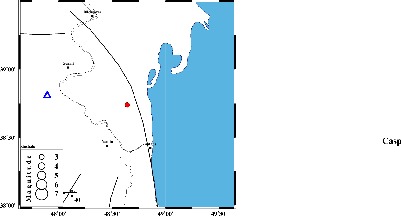
| Location | Lat:38.739 Lon: 48.642 |
| Region | Azerbaijan, 37 km North-East of Namin |
Nearest Cities |
|
| 31 km North East of Anbaran, Ardebil Province | |
| 32 km North East of Lurun, Ardebil Province | |
| 36 km North East of Khaneh zeinian, Ardebil Province | |
| 37 km North East of Namin, Ardebil Province | |
| 40 km North of Kiladeh, Gilan Province | |
| Depth | 14 km |
| Agency | |
Faults within 150 km: |
|
| TALESH_F (Length: 258 km) , Distance to epicenter: 15 km | |
| SANGAVAR_F (Length: 61 km) , Distance to epicenter: 59 km | |
| BOZQUSH (Length: 70 km) , Distance to epicenter: 68 km | |
| Number of Phases | 8 |
| RMS | 0.2 |
| Number of Stations | 6 |
| Error in Latitude | >2.8 km |
| Error in Longitude | 4.3 km |
| Error in Depth | 8.3 km |
Download waveform in seisan format
to download seisan software Click here
to access information about IIEES stations Click here
Amplitude | ||||||||
| UID | Agency | Station | Component | Amplitude | Period | Arrival Time | Proccessing Time | Signal Clip |
| 106429 | IIEES | GRMI | E | 946.2 | 0.13 | 2016-05-29 23:39:59 | 2016-05-30 05:31:00 | n |
| 106430 | IIEES | GRMI | N | 785.2 | 0.15 | 2016-05-29 23:40:00 | 2016-05-30 05:31:00 | n |
Phase | ||||||||||||
| Agency | Station | Component | Phase Type | Phase Quality | First Motion | Observed Arrival Time | Time Residual | Loc. Flag | Input Weight | Distance | Azimuth | |
| IIEES | GRMI | Z | Pg | E | 2016-05-29 23:39:51 | 0.12 | y | 65.5 | 277 | |||
| IIEES | GRMI | N | Sg | E | 2016-05-29 23:39:59 | -0.11 | y | 65.5 | 277 | |||
| IIEES | ZNJK | Z | Pn | E | 2016-05-29 23:40:16 | 0.39 | y | 230 | 179 | |||
| IIEES | ZNJK | N | Sg | E | 2016-05-29 23:40:44 | -0.16 | y | 230 | 179 | |||
| IIEES | CHTH | Z | Pn | E | 2016-05-29 23:40:35 | -0.01 | y | 384 | 144 | |||
| IIEES | MRVT | Z | Pn | E | 2016-05-29 23:41:09 | -0.23 | y | 663 | 98 | |||
| IIEES | SHRO | Z | Pn | E | 2016-05-29 23:41:16 | -0.06 | y | 719 | 113 | |||
| IIEES | BJRD | Z | Pn | E | 2016-05-29 23:41:23 | -0.27 | y | 776 | 96 | |||