
Magnitude |
2.1 |
| Date & Time (UTC) | 2016-07-13 22:58:59.0 |
| Date & Time (Local) | 1395/4/24 03:28:59.0 |
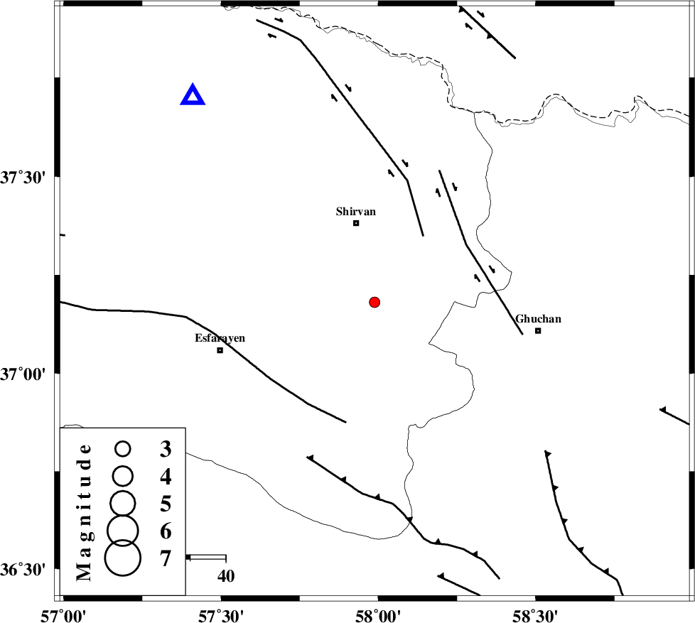
| Location | Lat:37.181 Lon: 57.988 |
| Region | Khorasan(center) Province, 23 km South of Shirvan |
Nearest Cities |
|
| 6 km of Maviyan, Khorasan(center) Province | |
| 9 km of Geliyan, Khorasan(north) Province | |
| 16 km North West of Chari, Khorasan(center) Province | |
| 21 km West of Faruj, Khorasan(center) Province | |
| 23 km South of Amirabad, Khorasan(north) Province | |
| Depth | 14 km |
| Agency | |
Faults within 150 km: |
|
| BAGHAN_GERMAB_F (Length: 79 km) , Distance to epicenter: 23 km | |
| GHUCHAN_F (Length: 50 km) , Distance to epicenter: 31 km | |
| ESFARAYEN_F (Length: 111 km) , Distance to epicenter: 34 km | |
| Number of Phases | 7 |
| RMS | 0.1 |
| Number of Stations | 5 |
| Error in Latitude | >1.9 km |
| Error in Longitude | 3.3 km |
| Error in Depth | 6.1 km |
Download waveform in seisan format
to download seisan software Click here
to access information about IIEES stations Click here
Amplitude | ||||||||
| UID | Agency | Station | Component | Amplitude | Period | Arrival Time | Proccessing Time | Signal Clip |
| 107683 | IIEES | BJRD | N | 63 | 0.18 | 2016-07-13 22:59:23 | 2016-07-16 09:37:00 | n |
| 107684 | IIEES | BJRD | E | 75.4 | 0.28 | 2016-07-13 22:59:27 | 2016-07-16 09:37:00 | n |
| 107685 | IIEES | MRVT | E | 37 | 0.27 | 2016-07-13 22:59:54 | 2016-07-16 09:37:00 | n |
| 107686 | IIEES | MRVT | N | 29.3 | 0.27 | 2016-07-13 22:59:54 | 2016-07-16 09:37:00 | n |
| 107687 | IIEES | SHRT | E | 1.3 | 0.25 | 2016-07-13 23:00:50 | 2016-07-16 09:37:00 | n |
| 107688 | IIEES | SHRT | N | 1.6 | 0.46 | 2016-07-13 23:00:52 | 2016-07-16 09:37:00 | n |
Phase | ||||||||||||
| Agency | Station | Component | Phase Type | Phase Quality | First Motion | Observed Arrival Time | Time Residual | Loc. Flag | Input Weight | Distance | Azimuth | |
| IIEES | BJRD | Z | Pg | E | 2016-07-13 22:59:12 | -0.1 | y | 77.2 | 318 | |||
| IIEES | MRVT | Z | Pg | E | 2016-07-13 22:59:27 | -0.13 | y | 176 | 288 | |||
| IIEES | MRVT | E | Sg | E | 2016-07-13 22:59:49 | 0.16 | y | 176 | 288 | |||
| IIEES | SHRO | Z | Pn | E | 2016-07-13 22:59:34 | 0.16 | y | 219 | 234 | |||
| IIEES | SHRO | E | Sg | E | 2016-07-13 23:00:01 | -0.13 | y | 219 | 234 | |||
| IIEES | TABS | Z | Pn | E | 2016-07-13 22:59:56 | 0.03 | y | 400 | 192 | |||
| IIEES | SHRT | Z | Pn | E | 2016-07-13 23:00:01 | 0.02 | y | 444 | 151 | |||