
Magnitude |
2.5 |
| Date & Time (UTC) | 2016-09-17 02:23:34.5 |
| Date & Time (Local) | 1395/6/27 06:53:34.5 |
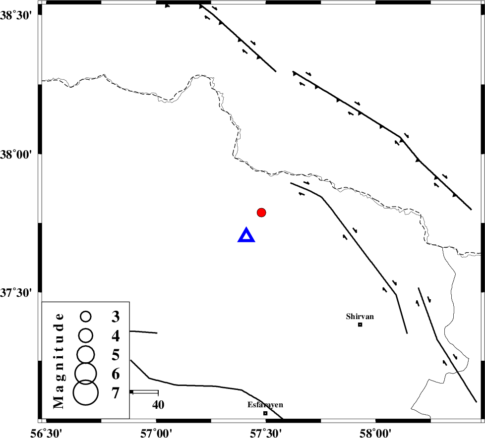
| Location | Lat:37.788 Lon: 57.479 |
| Region | Khorasan(north) Province, 37 km North-East of Bojnurd |
Nearest Cities |
|
| 12 km South of Gifan olia, Khorasan(north) Province | |
| 24 km North West of Yangi ghale-ye bala, Khorasan(north) Province | |
| 30 km North of Hesar-egarmkhanh, Khorasan(north) Province | |
| 32 km North West of Tukur, Khorasan(north) Province | |
| 35 km South East of Raz, Khorasan(north) Province | |
| Depth | 14 km |
| Agency | |
Faults within 150 km: |
|
| BAGHAN_GERMAB_F (Length: 79 km) , Distance to epicenter: 17 km | |
| MAIN_KOPEHDAGH_F3 (Length: 96 km) , Distance to epicenter: 56 km | |
| MAIN_KOPEHDAGH_F2 (Length: 131 km) , Distance to epicenter: 57 km | |
| Number of Phases | 4 |
| RMS | 0.2 |
| Number of Stations | 3 |
| Error in Latitude | >4.5 km |
| Error in Longitude | 9.3 km |
| Error in Depth | 4.4 km |
Download waveform in seisan format
to download seisan software Click here
to access information about IIEES stations Click here
Amplitude | ||||||||
| UID | Agency | Station | Component | Amplitude | Period | Arrival Time | Proccessing Time | Signal Clip |
| 109221 | IIEES | MRVT | N | 103.5 | 0.28 | 2016-09-17 02:24:12 | 2016-09-17 05:15:00 | n |
| 109222 | IIEES | MRVT | E | 103.6 | 0.28 | 2016-09-17 02:24:16 | 2016-09-17 05:15:00 | n |
Phase | ||||||||||||
| Agency | Station | Component | Phase Type | Phase Quality | First Motion | Observed Arrival Time | Time Residual | Loc. Flag | Input Weight | Distance | Azimuth | |
| IIEES | BJRD | Z | Pg | E | 2016-09-17 02:23:37 | -0.32 | y | 11.6 | 213 | |||
| IIEES | MRVT | Z | Pg | E | 2016-09-17 02:23:55 | -0.01 | y | 123 | 264 | |||
| IIEES | SHRO | Z | Pn | E | 2016-09-17 02:24:12 | 0.37 | y | 237 | 214 | |||
| IIEES | SHRO | N | Sg | E | 2016-09-17 02:24:41 | -0.04 | y | 237 | 214 | |||