
Magnitude |
2.7 |
| Date & Time (UTC) | 2017-01-12 15:07:53.0 |
| Date & Time (Local) | 1395/10/23 18:37:53.0 |
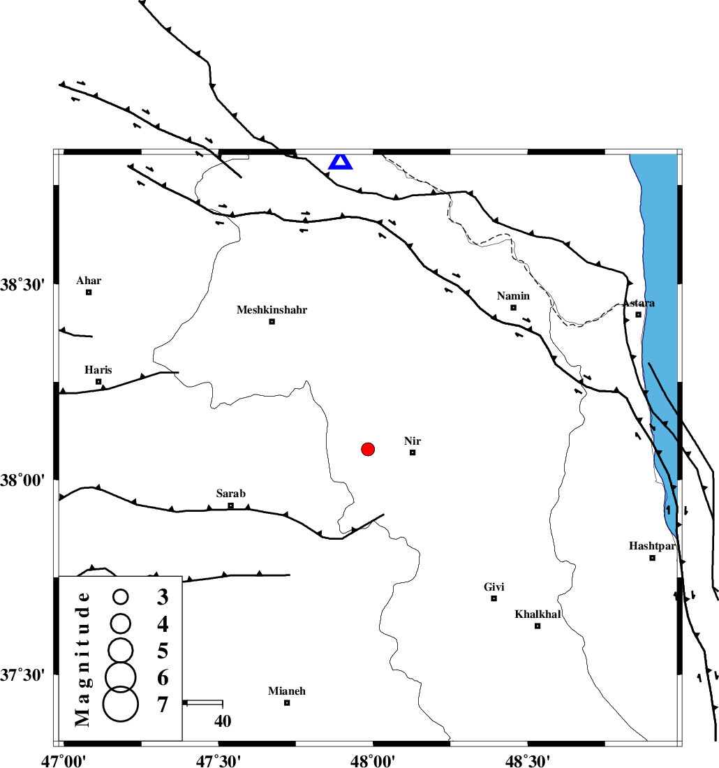
| Location | Lat:38.078 Lon: 47.983 |
| Region | Ardebil Province, 13 km -West of Nir |
Nearest Cities |
|
| 9 km of Eslamabad, Ardebil Province | |
| 13 km North of Qarehshiran, Ardebil Province | |
| 13 km North West of Nir, Ardebil Province | |
| 14 km West of Varniab, Ardebil Province | |
| 14 km West of Rezaqoli qeshlaq, Ardebil Province | |
| Depth | 15 km |
| Agency | |
Faults within 150 km: |
|
| BOZQUSH (Length: 70 km) , Distance to epicenter: 12 km | |
| SANGAVAR_F (Length: 61 km) , Distance to epicenter: 44 km | |
| MASULEL_F (Length: 90 km) , Distance to epicenter: 66 km | |
| Number of Phases | 8 |
| RMS | 0.2 |
| Number of Stations | 6 |
| Error in Latitude | >2.2 km |
| Error in Longitude | 7.6 km |
| Error in Depth | 6.5 km |
Download waveform in seisan format
to download seisan software Click here
to access information about IIEES stations Click here
Amplitude | ||||||||
| UID | Agency | Station | Component | Amplitude | Period | Arrival Time | Proccessing Time | Signal Clip |
| 112256 | IIEES | GRMI | E | 248.4 | 0.18 | 2017-01-12 15:08:18 | 2017-01-14 06:33:00 | n |
| 112257 | IIEES | GRMI | N | 217.7 | 0.35 | 2017-01-12 15:08:19 | 2017-01-14 06:33:00 | n |
| 112258 | IIEES | ZNJK | E | 67.9 | 0.46 | 2017-01-12 15:08:47 | 2017-01-14 06:33:00 | n |
| 112259 | IIEES | GIDE | N | 101.5 | 0.31 | 2017-01-12 15:08:57 | 2017-01-14 06:33:00 | n |
| 112260 | IIEES | GIDE | E | 69.9 | 0.47 | 2017-01-12 15:08:59 | 2017-01-14 06:33:00 | n |
| 112261 | IIEES | SNGE | E | 11.6 | 0.61 | 2017-01-12 15:09:34 | 2017-01-14 06:33:00 | n |
Phase | ||||||||||||
| Agency | Station | Component | Phase Type | Phase Quality | First Motion | Observed Arrival Time | Time Residual | Loc. Flag | Input Weight | Distance | Azimuth | |
| IIEES | GRMI | Z | Pg | E | 2017-01-12 15:08:07 | -0.07 | y | 81.6 | 355 | |||
| IIEES | GRMI | N | Sg | E | 2017-01-12 15:08:17 | -0.01 | y | 81.6 | 355 | |||
| IIEES | ZNJK | Z | Pg | E | 2017-01-12 15:08:20 | -0.37 | y | 168 | 158 | |||
| IIEES | GIDE | Z | Pn | E | 2017-01-12 15:08:27 | 0.25 | y | 213 | 126 | |||
| IIEES | MAKU | Z | Pn | E | 2017-01-12 15:08:44 | 4.42 | n | 4 | 320 | 297 | ||
| IIEES | SNGE | Z | Pn | E | 2017-01-12 15:08:42 | 0.34 | y | 336 | 190 | |||
| IIEES | ASAO | Z | Pn | E | 2017-01-12 15:08:54 | -0.24 | y | 432 | 154 | |||
| IIEES | MRVT | Z | Pn | E | 2017-01-12 15:09:29 | 0.19 | y | 715 | 91 | |||