
Magnitude |
2.8 |
| Date & Time (UTC) | 2017-01-16 08:12:18.2 |
| Date & Time (Local) | 1395/10/27 11:42:18.2 |
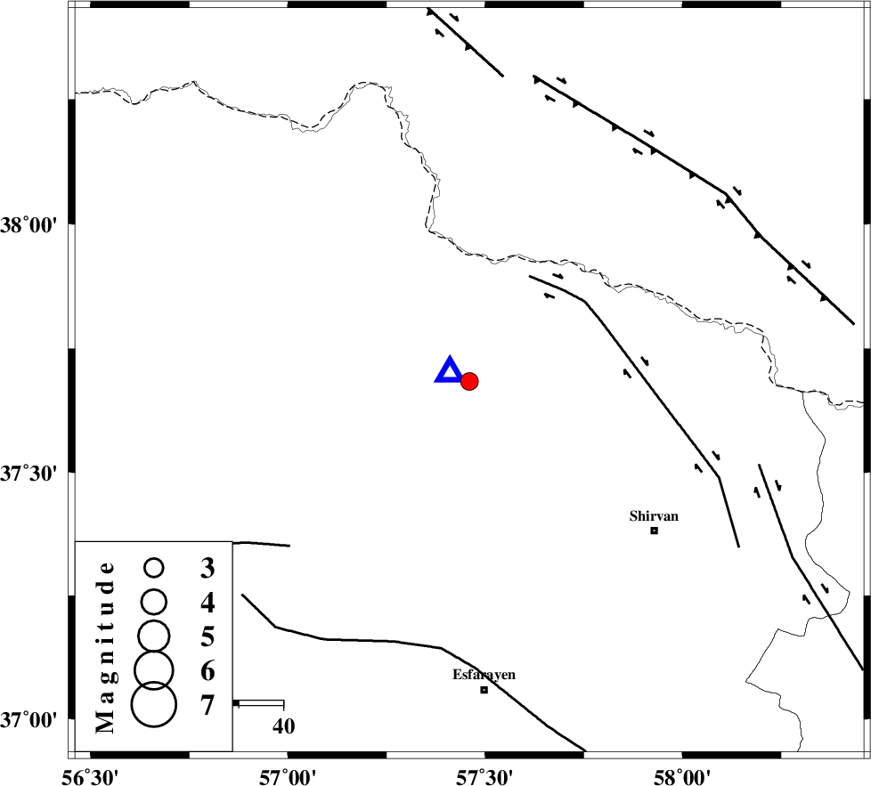
| Location | Lat:37.683 Lon: 57.46 |
| Region | Khorasan(north) Province, 26 km North-East of Bojnurd |
Nearest Cities |
|
| 19 km North of Hesar-egarmkhanh, Khorasan(north) Province | |
| 24 km South of Gifan olia, Khorasan(north) Province | |
| 26 km West of Yangi ghale-ye bala, Khorasan(north) Province | |
| 26 km North East of Void, Khorasan(north) Province | |
| 26 km North East of Bojnurd, Khorasan(north) Province | |
| Depth | 14 km |
| Agency | |
Faults within 150 km: |
|
| BAGHAN_GERMAB_F (Length: 79 km) , Distance to epicenter: 27 km | |
| ROBATE_QARABIL_F (Length: 168 km) , Distance to epicenter: 55 km | |
| ESFARAYEN_F (Length: 111 km) , Distance to epicenter: 60 km | |
| Number of Phases | 5 |
| RMS | 0.4 |
| Number of Stations | 4 |
| Error in Latitude | >5.8 km |
| Error in Longitude | 9.7 km |
| Error in Depth | 5.6 km |
Download waveform in seisan format
to download seisan software Click here
to access information about IIEES stations Click here
Amplitude | ||||||||
| UID | Agency | Station | Component | Amplitude | Period | Arrival Time | Proccessing Time | Signal Clip |
| 112341 | IIEES | BJRD | N | 8781 | 0.17 | 2017-01-16 08:12:23 | 2017-01-17 05:00:00 | n |
| 112342 | IIEES | MRVT | E | 115.8 | 0.27 | 2017-01-16 08:13:00 | 2017-01-17 05:00:00 | n |
Phase | ||||||||||||
| Agency | Station | Component | Phase Type | Phase Quality | First Motion | Observed Arrival Time | Time Residual | Loc. Flag | Input Weight | Distance | Azimuth | |
| IIEES | BJRD | Z | Pg | E | 2017-01-16 08:12:20 | -0.48 | y | 4.92 | 292 | |||
| IIEES | MRVT | Z | Pg | E | 2017-01-16 08:12:38 | 0.22 | y | 121 | 269 | |||
| IIEES | SHRO | Z | Pn | E | 2017-01-16 08:12:54 | 0.51 | y | 226 | 215 | |||
| IIEES | SHRO | N | Sg | E | 2017-01-16 08:13:22 | -0.31 | y | 226 | 215 | |||
| IIEES | TABS | Z | Pn | E | 2017-01-16 08:13:21 | 0.07 | y | 449 | 184 | |||