
Magnitude |
2.6 |
| Date & Time (UTC) | 2017-01-28 12:56:10.8 |
| Date & Time (Local) | 1395/11/9 16:26:10.8 |
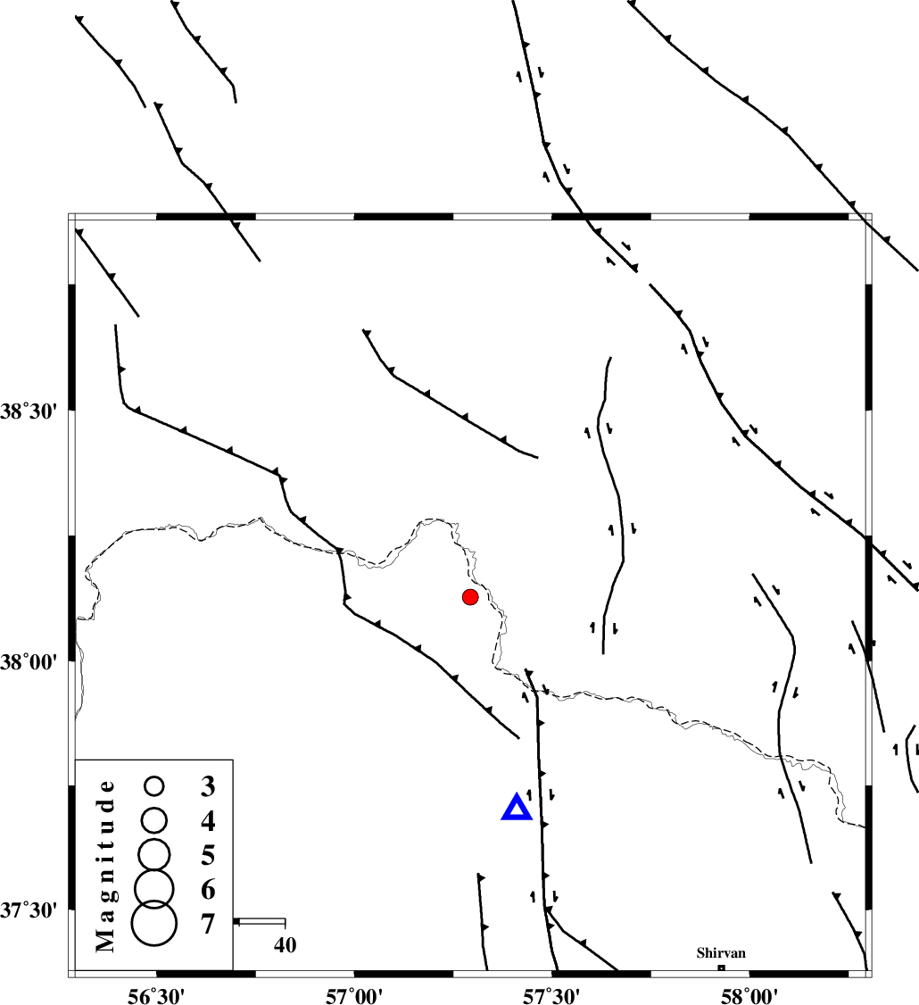
| Location | Lat:38.127 Lon: 57.293 |
| Region | Khorasan(north) Province, 73 km North of Bojnurd |
Nearest Cities |
|
| 26 km North East of Raz, Khorasan(north) Province | |
| 31 km North West of Gifan olia, Khorasan(north) Province | |
| 37 km North East of Tangehzar, Khorasan(north) Province | |
| 50 km East of Yekehsoud-e paeen, Khorasan(north) Province | |
| 58 km North West of Yangi ghale-ye bala, Khorasan(north) Province | |
| Depth | 17 km |
| Agency | |
Faults within 150 km: |
|
| MAIN_KOPEHDAGH_F2 (Length: 131 km) , Distance to epicenter: 29 km | |
| MAIN_KOPEHDAGH_F3 (Length: 96 km) , Distance to epicenter: 34 km | |
| BAGHAN_GERMAB_F (Length: 79 km) , Distance to epicenter: 38 km | |
| Number of Phases | 4 |
| RMS | 0 |
| Number of Stations | 3 |
| Error in Latitude | >6.7 km |
| Error in Longitude | 2.5 km |
| Error in Depth | 3.6 km |
Download waveform in seisan format
to download seisan software Click here
to access information about IIEES stations Click here
Amplitude | ||||||||
| UID | Agency | Station | Component | Amplitude | Period | Arrival Time | Proccessing Time | Signal Clip |
| 112777 | IIEES | BJRD | E | 466.4 | 0.53 | 2017-01-28 12:56:37 | 2017-01-29 06:56:00 | n |
| 112778 | IIEES | MRVT | E | 187.6 | 0.49 | 2017-01-28 12:56:48 | 2017-01-29 06:56:00 | n |
| 112779 | IIEES | MRVT | N | 124.2 | 0.49 | 2017-01-28 12:56:50 | 2017-01-29 06:56:00 | n |
Phase | ||||||||||||
| Agency | Station | Component | Phase Type | Phase Quality | First Motion | Observed Arrival Time | Time Residual | Loc. Flag | Input Weight | Distance | Azimuth | |
| IIEES | BJRD | Z | Pg | E | 2017-01-28 12:56:19 | -0.01 | y | 48.5 | 168 | |||
| IIEES | MRVT | Z | Pg | E | 2017-01-28 12:56:30 | 0 | y | 118 | 244 | |||
| IIEES | MRVT | N | Sg | E | 2017-01-28 12:56:45 | 0 | y | 118 | 244 | |||
| IIEES | SHRO | Z | Pn | E | 2017-01-28 12:56:50 | 0 | y | 261 | 206 | |||