
Magnitude |
4.3 |
| Date & Time (UTC) | 2017-04-05 06:24:29.9 |
| Date & Time (Local) | 1396/1/16 10:54:29.9 |
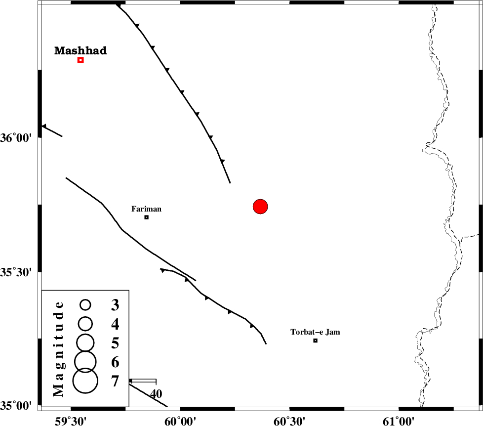
| Location | Lat:35.743 Lon: 60.366 |
| Region | Khorasan(center) Province, 47 km -East of Fariman |
Nearest Cities |
|
| 25 km South East of Kalateh menar, Khorasan(center) Province | |
| 27 km North West of Musaabad, Khorasan(center) Province | |
| 28 km North East of Sefidsang, Khorasan(center) Province | |
| 37 km North of Nasrabad, Khorasan(center) Province | |
| 39 km North East of Galandarabad, Khorasan(center) Province | |
| Depth | 15 km |
| Agency | |
Faults within 150 km: |
|
| BINALUD_F1 (Length: 178 km) , Distance to epicenter: 16 km | |
| TORBAT_E_JAM_F1 (Length: 71 km) , Distance to epicenter: 41 km | |
| TORBAT_E_JAM_F2 (Length: 57 km) , Distance to epicenter: 43 km | |
| Number of Phases | 7 |
| RMS | 0.1 |
| Number of Stations | 7 |
| Error in Latitude | >2.1 km |
| Error in Longitude | 1.8 km |
| Error in Depth | 0 km |
Download waveform in seisan format
to download seisan software Click here
to access information about IIEES stations Click here
Amplitude | ||||||||
| UID | Agency | Station | Component | Amplitude | Period | Arrival Time | Proccessing Time | Signal Clip |
| 114577 | IIEES | BJRD | E | 784.4 | 0.47 | 2017-04-05 06:26:15 | 2017-04-05 06:51:00 | n |
| 114578 | IIEES | BJRD | N | 540.6 | 0.39 | 2017-04-05 06:26:16 | 2017-04-05 06:51:00 | n |
| 114579 | IIEES | TABS | N | 607.5 | 0.83 | 2017-04-05 06:26:50 | 2017-04-05 06:51:00 | n |
Phase | ||||||||||||
| Agency | Station | Component | Phase Type | Phase Quality | First Motion | Observed Arrival Time | Time Residual | Loc. Flag | Input Weight | Distance | Azimuth | |
| IIEES | SHRT | Z | Pn | E | 2017-04-05 06:25:06 | -0.07 | y | 233 | 182 | |||
| IIEES | BJRD | Z | Pn | E | 2017-04-05 06:25:20 | 0.04 | y | 342 | 310 | |||
| IIEES | TABS | Z | Pn | E | 2017-04-05 06:25:24 | -0.06 | y | 377 | 233 | |||
| IIEES | SHRO | Z | Pn | E | 2017-04-05 06:25:26 | -0.09 | y | 394 | 276 | |||
| IIEES | BSRN | Z | Pn | E | 2017-04-05 06:25:31 | 0.11 | y | 434 | 196 | |||
| IIEES | MRVT | Z | Pn | E | 2017-04-05 06:25:31 | 0.01 | y | 437 | 300 | |||
| IIEES | YZKH | Z | Pn | E | 2017-04-05 06:25:58 | 0.15 | y | 650 | 237 | |||