
Magnitude |
3.1 |
| Date & Time (UTC) | 2017-04-05 08:12:17.1 |
| Date & Time (Local) | 1396/1/16 12:42:17.1 |
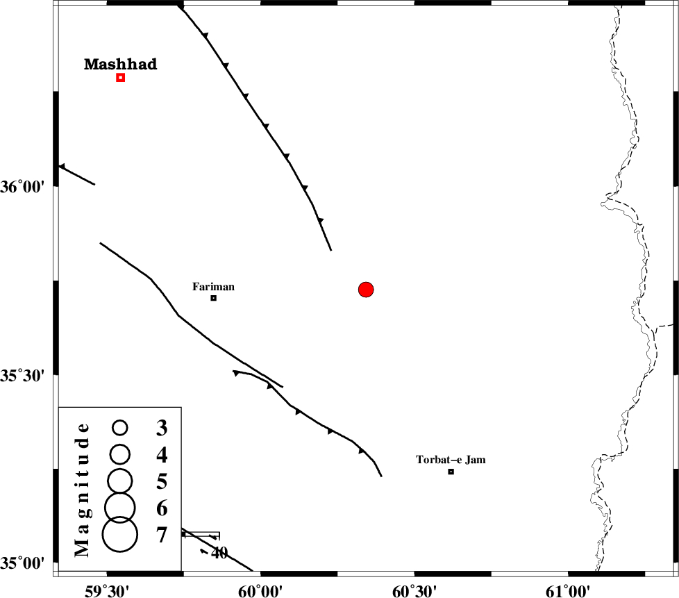
| Location | Lat:35.726 Lon: 60.342 |
| Region | Khorasan(center) Province, 45 km -East of Fariman |
Nearest Cities |
|
| 25 km North East of Sefidsang, Khorasan(center) Province | |
| 25 km South East of Kalateh menar, Khorasan(center) Province | |
| 28 km North West of Musaabad, Khorasan(center) Province | |
| 35 km North of Nasrabad, Khorasan(center) Province | |
| 37 km North East of Galandarabad, Khorasan(center) Province | |
| Depth | 15 km |
| Agency | |
Faults within 150 km: |
|
| BINALUD_F1 (Length: 178 km) , Distance to epicenter: 15 km | |
| TORBAT_E_JAM_F1 (Length: 71 km) , Distance to epicenter: 38 km | |
| TORBAT_E_JAM_F2 (Length: 57 km) , Distance to epicenter: 40 km | |
| Number of Phases | 7 |
| RMS | 0.3 |
| Number of Stations | 7 |
| Error in Latitude | >5 km |
| Error in Longitude | 4.2 km |
| Error in Depth | 0 km |
Download waveform in seisan format
to download seisan software Click here
to access information about IIEES stations Click here
Amplitude | ||||||||
| UID | Agency | Station | Component | Amplitude | Period | Arrival Time | Proccessing Time | Signal Clip |
| 114615 | IIEES | SHRT | E | 76.7 | 0.28 | 2017-04-05 08:13:25 | 2017-04-05 09:11:00 | n |
| 114616 | IIEES | SHRT | N | 87.4 | 0.39 | 2017-04-05 08:13:27 | 2017-04-05 09:11:00 | n |
| 114617 | IIEES | BJRD | E | 49.8 | 0.51 | 2017-04-05 08:13:58 | 2017-04-05 09:11:00 | n |
| 114618 | IIEES | BJRD | N | 68 | 0.41 | 2017-04-05 08:14:03 | 2017-04-05 09:11:00 | n |
Phase | ||||||||||||
| Agency | Station | Component | Phase Type | Phase Quality | First Motion | Observed Arrival Time | Time Residual | Loc. Flag | Input Weight | Distance | Azimuth | |
| IIEES | SHRT | Z | Pn | E | 2017-04-05 08:12:53 | -0.33 | y | 231 | 181 | |||
| IIEES | BJRD | Z | Pn | E | 2017-04-05 08:13:07 | 0 | y | 342 | 311 | |||
| IIEES | TABS | Z | Pn | E | 2017-04-05 08:13:11 | 0.23 | y | 375 | 233 | |||
| IIEES | SHRO | Z | Pn | E | 2017-04-05 08:13:13 | -0.09 | y | 392 | 276 | |||
| IIEES | BSRN | Z | Pn | E | 2017-04-05 08:13:19 | 0.57 | y | 432 | 195 | |||
| IIEES | MRVT | Z | Pn | E | 2017-04-05 08:13:19 | 0.09 | y | 436 | 301 | |||
| IIEES | YZKH | Z | Pn | E | 2017-04-05 08:13:44 | -0.56 | y | 647 | 237 | |||