
Magnitude |
4.3 |
| Date & Time (UTC) | 2017-04-05 15:36:46.7 |
| Date & Time (Local) | 1396/1/16 20:06:46.7 |
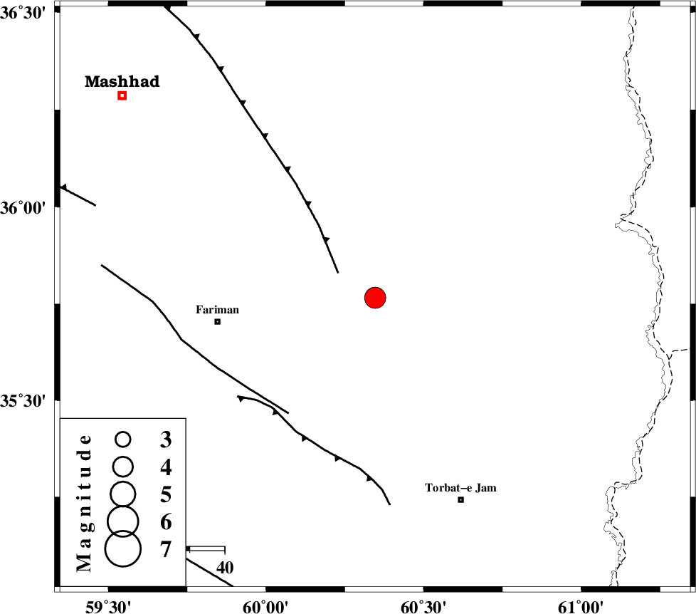
| Location | Lat:35.766 Lon: 60.346 |
| Region | Khorasan(center) Province, 46 km -East of Fariman |
Nearest Cities |
|
| 22 km South East of Kalateh menar, Khorasan(center) Province | |
| 27 km North East of Sefidsang, Khorasan(center) Province | |
| 31 km North West of Musaabad, Khorasan(center) Province | |
| 39 km North East of Galandarabad, Khorasan(center) Province | |
| 39 km North of Nasrabad, Khorasan(center) Province | |
| Depth | 15 km |
| Agency | |
Faults within 150 km: |
|
| BINALUD_F1 (Length: 178 km) , Distance to epicenter: 13 km | |
| TORBAT_E_JAM_F1 (Length: 71 km) , Distance to epicenter: 41 km | |
| TORBAT_E_JAM_F2 (Length: 57 km) , Distance to epicenter: 43 km | |
| Number of Phases | 8 |
| RMS | 0.3 |
| Number of Stations | 8 |
| Error in Latitude | >4.2 km |
| Error in Longitude | 3.7 km |
| Error in Depth | 0 km |
Download waveform in seisan format
to download seisan software Click here
to access information about IIEES stations Click here
Amplitude | ||||||||
| UID | Agency | Station | Component | Amplitude | Period | Arrival Time | Proccessing Time | Signal Clip |
| 114667 | IIEES | BJRD | E | 936.6 | 0.27 | 2017-04-05 15:38:26 | 2017-04-06 06:41:00 | n |
| 114668 | IIEES | BJRD | N | 653.8 | 0.34 | 2017-04-05 15:38:32 | 2017-04-06 06:41:00 | n |
| 114669 | IIEES | TABS | N | 365.2 | 0.58 | 2017-04-05 15:38:45 | 2017-04-06 06:41:00 | n |
Phase | ||||||||||||
| Agency | Station | Component | Phase Type | Phase Quality | First Motion | Observed Arrival Time | Time Residual | Loc. Flag | Input Weight | Distance | Azimuth | |
| IIEES | SHRT | Z | Pn | E | 2017-04-05 15:37:23 | -0.27 | y | 235 | 181 | |||
| IIEES | BJRD | Z | Pn | E | 2017-04-05 15:37:36 | -0.13 | y | 339 | 310 | |||
| IIEES | TABS | Z | Pn | E | 2017-04-05 15:37:41 | -0.08 | y | 378 | 232 | |||
| IIEES | SHRO | Z | Pn | E | 2017-04-05 15:37:42 | -0.18 | y | 392 | 275 | |||
| IIEES | MRVT | Z | Pn | E | 2017-04-05 15:37:48 | 0.35 | y | 434 | 300 | |||
| IIEES | BSRN | Z | Pn | E | 2017-04-05 15:37:49 | 0.48 | y | 436 | 195 | |||
| IIEES | YZKH | Z | Pn | E | 2017-04-05 15:38:15 | 0.26 | y | 650 | 236 | |||
| IIEES | NASN | Z | Pn | E | 2017-04-05 15:38:29 | -0.39 | y | 768 | 247 | |||