
Magnitude |
2.5 |
| Date & Time (UTC) | 2017-04-14 21:14:32.9 |
| Date & Time (Local) | 1396/1/26 01:44:32.9 |
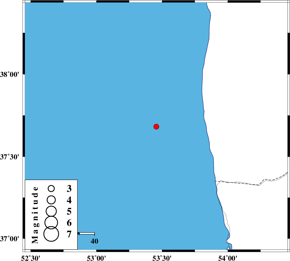
| Location | Lat:37.682 Lon: 53.456 |
| Region | Caspian Sea |
Nearest Cities |
|
| 85 km North West of Gomishtappeh, Golestan Province | |
| 98 km North East of Zaghmarz, Mazandaran Province | |
| 101 km North West of Banavar, Golestan Province | |
| 103 km North West of Bandar-e torkaman, Golestan Province | |
| 104 km North East of Farahabad, Mazandaran Province | |
| Depth | 15 km |
| Agency | |
Faults within 150 km: |
|
| KHAZAR_F (Length: 523 km) , Distance to epicenter: 110 km | |
| N_ALBORZ_F (Length: 360 km) , Distance to epicenter: 138 km | |
| SHAVAR_F (Length: 87 km) , Distance to epicenter: 150 km | |
| Number of Phases | 7 |
| RMS | 0.2 |
| Number of Stations | 7 |
| Error in Latitude | >8.2 km |
| Error in Longitude | 1.5 km |
| Error in Depth | 0 km |
Download waveform in seisan format
to download seisan software Click here
to access information about IIEES stations Click here
Amplitude | ||||||||
| UID | Agency | Station | Component | Amplitude | Period | Arrival Time | Proccessing Time | Signal Clip |
| 115005 | IIEES | THKV | E | 14.4 | 0.43 | 2017-04-14 21:16:00 | 2017-04-15 07:21:00 | n |
| 115006 | IIEES | THKV | N | 18.9 | 0.5 | 2017-04-14 21:16:01 | 2017-04-15 07:21:00 | n |
| 115007 | IIEES | GHVR | E | 6.9 | 0.56 | 2017-04-14 21:16:44 | 2017-04-15 07:21:00 | n |
Phase | ||||||||||||
| Agency | Station | Component | Phase Type | Phase Quality | First Motion | Observed Arrival Time | Time Residual | Loc. Flag | Input Weight | Distance | Azimuth | |
| IIEES | MRVT | Z | Pn | E | 2017-04-14 21:15:09 | -0.11 | y | 232 | 90 | |||
| IIEES | DAMV | Z | Pn | E | 2017-04-14 21:15:13 | -0.37 | y | 264 | 211 | |||
| IIEES | CHTH | Z | Pn | E | 2017-04-14 21:15:16 | -0.02 | y | 286 | 227 | |||
| IIEES | SHRO | Z | Pn | E | 2017-04-14 21:15:17 | 0.18 | y | 294 | 128 | |||
| IIEES | THKV | Z | Pn | E | 2017-04-14 21:15:18 | 0.31 | y | 302 | 230 | |||
| IIEES | GHVR | Z | Pn | E | 2017-04-14 21:15:31 | 0.12 | y | 407 | 210 | |||
| IIEES | ASAO | Z | Pn | E | 2017-04-14 21:15:38 | -0.08 | y | 465 | 223 | |||