
Magnitude |
3 |
| Date & Time (UTC) | 2017-04-05 07:05:20.8 |
| Date & Time (Local) | 1396/1/16 11:35:20.8 |
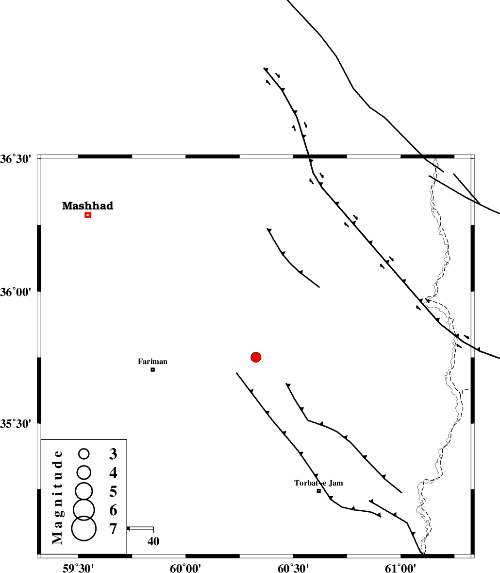
| Location | Lat:35.751 Lon: 60.326 |
| Region | Khorasan(center) Province, 44 km -East of Fariman |
Nearest Cities |
|
| 22 km South of Kalateh menar, Khorasan(center) Province | |
| 25 km North East of Sefidsang, Khorasan(center) Province | |
| 31 km North West of Musaabad, Khorasan(center) Province | |
| 37 km North East of Galandarabad, Khorasan(center) Province | |
| 37 km North of Nasrabad, Khorasan(center) Province | |
| Depth | 15 km |
| Agency | |
Faults within 150 km: |
|
| BINALUD_F1 (Length: 178 km) , Distance to epicenter: 12 km | |
| TORBAT_E_JAM_F1 (Length: 71 km) , Distance to epicenter: 39 km | |
| TORBAT_E_JAM_F2 (Length: 57 km) , Distance to epicenter: 41 km | |
| Number of Phases | 6 |
| RMS | 0.5 |
| Number of Stations | 6 |
| Error in Latitude | >8.1 km |
| Error in Longitude | 6.2 km |
| Error in Depth | 0 km |
Download waveform in seisan format
to download seisan software Click here
to access information about IIEES stations Click here
Amplitude | ||||||||
| UID | Agency | Station | Component | Amplitude | Period | Arrival Time | Proccessing Time | Signal Clip |
| 115093 | IIEES | SHRT | N | 62.8 | 0.36 | 2017-04-05 07:06:29 | 2017-04-17 05:23:00 | n |
| 115094 | IIEES | SHRT | E | 64 | 0.24 | 2017-04-05 07:06:29 | 2017-04-17 05:23:00 | n |
| 115095 | IIEES | BJRD | N | 42.4 | 0.59 | 2017-04-05 07:07:01 | 2017-04-17 05:23:00 | n |
| 115096 | IIEES | BJRD | E | 49.8 | 0.94 | 2017-04-05 07:07:11 | 2017-04-17 05:23:00 | n |
Phase | ||||||||||||
| Agency | Station | Component | Phase Type | Phase Quality | First Motion | Observed Arrival Time | Time Residual | Loc. Flag | Input Weight | Distance | Azimuth | |
| IIEES | SHRT | Z | Pn | E | 2017-04-05 07:05:57 | 0.56 | y | 234 | 181 | |||
| IIEES | BJRD | Z | Pn | E | 2017-04-05 07:06:10 | -0.36 | y | 339 | 311 | |||
| IIEES | TABS | Z | Pn | E | 2017-04-05 07:06:14 | -0.06 | y | 375 | 232 | |||
| IIEES | SHRO | Z | Pn | E | 2017-04-05 07:06:17 | 0.42 | y | 390 | 275 | |||
| IIEES | MRVT | Z | Pn | E | 2017-04-05 07:06:22 | 0.18 | y | 434 | 300 | |||
| IIEES | BSRN | Z | Pn | E | 2017-04-05 07:06:21 | -0.89 | y | 434 | 195 | |||