
Magnitude |
2.6 |
| Date & Time (UTC) | 2017-04-07 05:38:07.9 |
| Date & Time (Local) | 1396/1/18 10:08:07.9 |
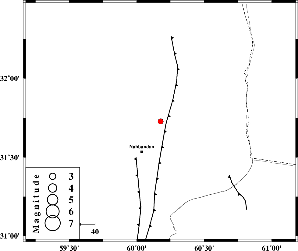
| Location | Lat:31.728 Lon: 60.177 |
| Region | Khorasan(south) Province, 25 km North-East of Nehbandan |
Nearest Cities |
|
| 25 km North East of Nehbandan, Khorasan(south) Province | |
| 37 km South East of Shusef, Khorasan(south) Province | |
| 78 km South West of Dorj, Khorasan(south) Province | |
| 100 km South East of Salmabad, Khorasan(south) Province | |
| 106 km South East of Sarbisheh, Khorasan(south) Province | |
| Depth | 16 km |
| Agency | |
Faults within 150 km: |
|
| E_NEH_F (Length: 148 km) , Distance to epicenter: 4 km | |
| W_NEH_F (Length: 158 km) , Distance to epicenter: 30 km | |
| SEFIDABAD_F (Length: 26 km) , Distance to epicenter: 61 km | |
| Number of Phases | 6 |
| RMS | 0.1 |
| Number of Stations | 5 |
| Error in Latitude | >3.1 km |
| Error in Longitude | 3.9 km |
| Error in Depth | 5.4 km |
Download waveform in seisan format
to download seisan software Click here
to access information about IIEES stations Click here
Amplitude | ||||||||
| UID | Agency | Station | Component | Amplitude | Period | Arrival Time | Proccessing Time | Signal Clip |
| 115113 | IIEES | BSRN | N | 92.9 | 0.45 | 2017-04-07 05:38:45 | 2017-04-17 05:23:00 | n |
| 115114 | IIEES | TABS | N | 9.1 | 0.8 | 2017-04-07 05:40:01 | 2017-04-17 05:23:00 | n |
| 115115 | IIEES | KRBR | E | 9.7 | 0.4 | 2017-04-07 05:40:09 | 2017-04-17 05:23:00 | n |
| 115116 | IIEES | KRBR | N | 12 | 0.58 | 2017-04-07 05:40:12 | 2017-04-17 05:23:00 | n |
| 115117 | IIEES | YZKH | N | 3.6 | 0.49 | 2017-04-07 05:40:48 | 2017-04-17 05:23:00 | n |
| 115118 | IIEES | YZKH | E | 5.6 | 0.43 | 2017-04-07 05:40:54 | 2017-04-17 05:23:00 | n |
Phase | ||||||||||||
| Agency | Station | Component | Phase Type | Phase Quality | First Motion | Observed Arrival Time | Time Residual | Loc. Flag | Input Weight | Distance | Azimuth | |
| IIEES | BSRN | Z | Pg | E | 2017-04-07 05:38:25 | -0.08 | y | 103 | 285 | |||
| IIEES | BSRN | N | Sg | E | 2017-04-07 05:38:38 | 0.08 | y | 103 | 285 | |||
| IIEES | SHRT | Z | Pn | E | 2017-04-07 05:38:41 | 0.09 | y | 213 | 3 | |||
| IIEES | TABS | Z | Pn | E | 2017-04-07 05:38:59 | -0.14 | y | 357 | 307 | |||
| IIEES | KRBR | Z | Pn | E | 2017-04-07 05:39:02 | 0.07 | y | 380 | 240 | |||
| IIEES | YZKH | Z | Pn | E | 2017-04-07 05:39:21 | -0.03 | y | 532 | 279 | |||