
Magnitude |
3 |
| Date & Time (UTC) | 2017-06-09 17:22:20.7 |
| Date & Time (Local) | 1396/3/19 21:52:20.7 |
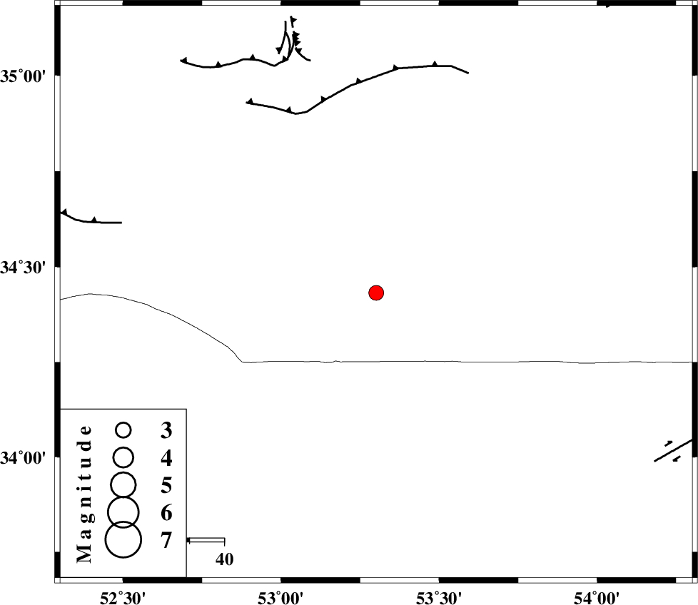
| Location | Lat:34.432 Lon: 53.301 |
| Region | Semnan Province, 127 km South of Semnan |
Nearest Cities |
|
| 87 km North of Maedan, Esfahan Province | |
| 110 km South East of Lasjerd, Semnan Province | |
| 111 km North West of Jondaq, Esfahan Province | |
| 112 km South East of Kohanabad, Semnan Province | |
| 115 km South of Sorkheh, Semnan Province | |
| Depth | 15 km |
| Agency | |
Faults within 150 km: |
|
| KUH_E_GUGERD_F (Length: 73 km) , Distance to epicenter: 56 km | |
| KUH_E_GACHAB_F1 (Length: 53 km) , Distance to epicenter: 73 km | |
| SIAHKUH_F (Length: 154 km) , Distance to epicenter: 75 km | |
| Number of Phases | 7 |
| RMS | 0.1 |
| Number of Stations | 5 |
| Error in Latitude | >1.4 km |
| Error in Longitude | 2.7 km |
| Error in Depth | 3.4 km |
Download waveform in seisan format
to download seisan software Click here
to access information about IIEES stations Click here
Amplitude | ||||||||
| UID | Agency | Station | Component | Amplitude | Period | Arrival Time | Proccessing Time | Signal Clip |
| 116629 | IIEES | DAMV | E | 145.8 | 0.32 | 2017-06-09 17:23:15 | 2017-06-10 04:56:00 | n |
| 116630 | IIEES | NASN | N | 131.2 | 0.36 | 2017-06-09 17:23:23 | 2017-06-10 04:56:00 | n |
| 116631 | IIEES | GHVR | E | 138.9 | 0.76 | 2017-06-09 17:23:23 | 2017-06-10 04:56:00 | n |
| 116632 | IIEES | GHVR | N | 170 | 0.57 | 2017-06-09 17:23:24 | 2017-06-10 04:56:00 | n |
Phase | ||||||||||||
| Agency | Station | Component | Phase Type | Phase Quality | First Motion | Observed Arrival Time | Time Residual | Loc. Flag | Input Weight | Distance | Azimuth | |
| IIEES | DAMV | Z | Pg | E | 2017-06-09 17:22:50 | 0.03 | y | 180 | 318 | |||
| IIEES | DAMV | N | Sg | E | 2017-06-09 17:23:12 | -0.04 | y | 180 | 318 | |||
| IIEES | NASN | Z | Pn | E | 2017-06-09 17:22:51 | 0.01 | y | 187 | 194 | |||
| IIEES | GHVR | Z | Pg | E | 2017-06-09 17:22:51 | -0.04 | y | 189 | 272 | |||
| IIEES | CHTH | Z | Pn | E | 2017-06-09 17:23:00 | 0.07 | y | 257 | 310 | |||
| IIEES | ASAO | Z | Pn | E | 2017-06-09 17:23:05 | -0.09 | y | 301 | 273 | |||
| IIEES | ASAO | N | Sg | E | 2017-06-09 17:23:45 | 0.05 | y | 301 | 273 | |||