
Magnitude |
3 |
| Date & Time (UTC) | 2017-10-16 10:29:24.1 |
| Date & Time (Local) | 1396/7/24 13:59:24.1 |
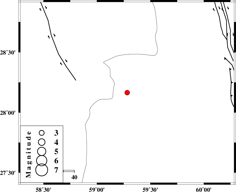
| Location | Lat:28.165 Lon: 59.283 |
| Region | Sistan va Baloochestan Province, 158 km North-East of Kahnuj |
Nearest Cities |
|
| 64 km South East of Hoseynabad, Kerman Province | |
| 73 km South East of Mohammadabad-e gonbaki, Kerman Province | |
| 77 km North East of Borj-e abbasabad, Kerman Province | |
| 80 km North West of Kalemursi, Sistan va Baloochestan Province | |
| 87 km South East of Void, Kerman Province | |
| Depth | 15 km |
| Agency | |
Faults within 150 km: |
|
| BAM_F (Length: 118 km) , Distance to epicenter: 48 km | |
| KANURAK_F (Length: 135 km) , Distance to epicenter: 94 km | |
| DAMAN_F (Length: 167 km) , Distance to epicenter: 95 km | |
| Number of Phases | 6 |
| RMS | 0.1 |
| Number of Stations | 6 |
| Error in Latitude | >3 km |
| Error in Longitude | 1 km |
| Error in Depth | 0 km |
Download waveform in seisan format
to download seisan software Click here
to access information about IIEES stations Click here
Amplitude | ||||||||
| UID | Agency | Station | Component | Amplitude | Period | Arrival Time | Proccessing Time | Signal Clip |
| 120507 | IIEES | BNDS | E | 55.3 | 0.46 | 2017-10-16 10:30:54 | 2017-10-17 06:17:00 | n |
| 120508 | IIEES | BNDS | N | 34.5 | 0.46 | 2017-10-16 10:30:51 | 2017-10-17 06:17:00 | n |
| 120509 | IIEES | KRBR | E | 42 | 0.46 | 2017-10-16 10:30:52 | 2017-10-17 06:17:00 | n |
| 120510 | IIEES | KRBR | N | 34 | 0.38 | 2017-10-16 10:30:55 | 2017-10-17 06:17:00 | n |
Phase | ||||||||||||
| Agency | Station | Component | Phase Type | Phase Quality | First Motion | Observed Arrival Time | Time Residual | Loc. Flag | Input Weight | Distance | Azimuth | |
| IIEES | ZHSF | Z | Pn | E | 2017-10-16 10:29:58 | -0.01 | y | 216 | 42 | |||
| IIEES | KRBR | Z | Pn | E | 2017-10-16 10:30:11 | -0.06 | y | 318 | 310 | |||
| IIEES | BNDS | Z | Pn | E | 2017-10-16 10:30:11 | 0.03 | y | 318 | 255 | |||
| IIEES | BSRN | Z | Pn | E | 2017-10-16 10:30:24 | -0.06 | y | 422 | 358 | |||
| IIEES | GHIR | Z | P | E | 2017-10-16 10:30:48 | -0.04 | y | 618 | 273 | |||
| IIEES | TABS | Z | Pn | E | 2017-10-16 10:30:51 | 0.19 | y | 642 | 342 | |||