
Magnitude |
2.5 |
| Date & Time (UTC) | 2017-10-30 02:48:57.0 |
| Date & Time (Local) | 1396/8/8 06:18:57.0 |
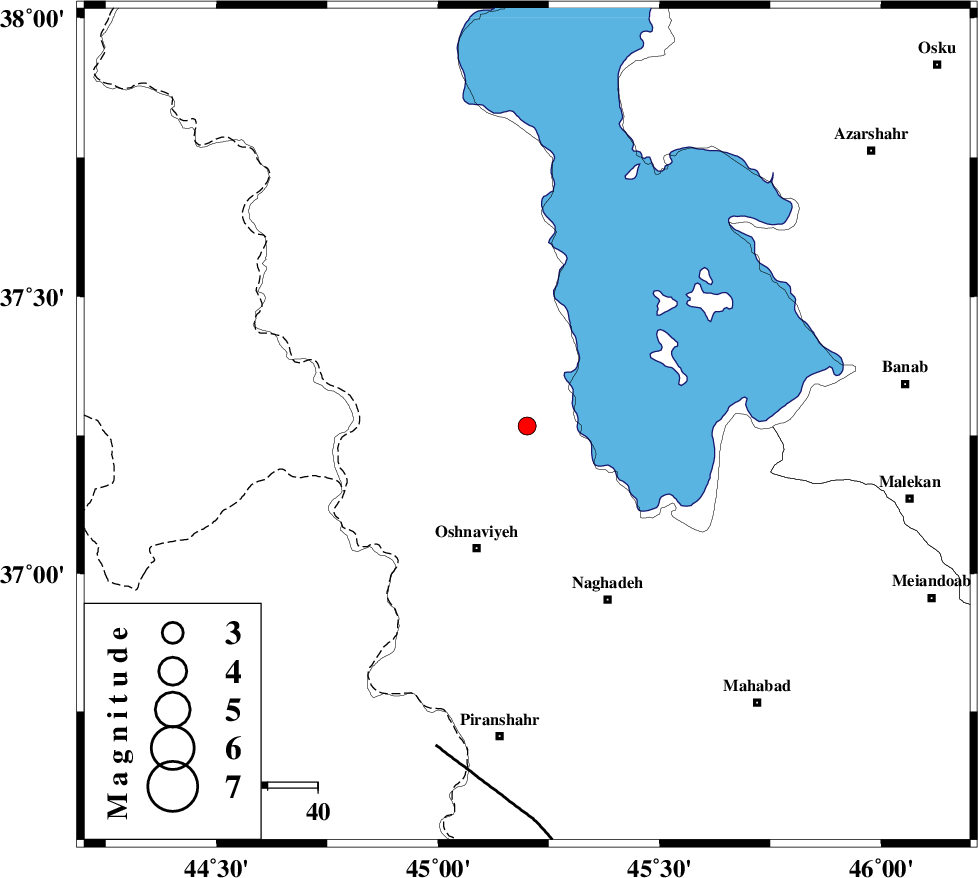
| Location | Lat:37.267 Lon: 45.201 |
| Region | Azarbaijan Gharbi Province, 27 km North-East of Oshnaviyeh |
Nearest Cities |
|
| 15 km North of Aghbelagh, Azarbaijan Gharbi Province | |
| 18 km South East of Baranduz, Azarbaijan Gharbi Province | |
| 19 km South of Torkaman, Azarbaijan Gharbi Province | |
| 23 km South of Qarehaghaj, Azarbaijan Gharbi Province | |
| 26 km North East of Ziveh, Azarbaijan Gharbi Province | |
| Depth | 18 km |
| Agency | |
Faults within 150 km: |
|
| PIRANSHAHR_F (Length: 253 km) , Distance to epicenter: 67 km | |
| SALMAS (Length: 20 km) , Distance to epicenter: 93 km | |
| N_TABRIZ_F2 (Length: 52 km) , Distance to epicenter: 105 km | |
| Number of Phases | 6 |
| RMS | 0.1 |
| Number of Stations | 4 |
| Error in Latitude | >3.3 km |
| Error in Longitude | 4.6 km |
| Error in Depth | 8.6 km |
Download waveform in seisan format
to download seisan software Click here
to access information about IIEES stations Click here
Amplitude | ||||||||
| UID | Agency | Station | Component | Amplitude | Period | Arrival Time | Proccessing Time | Signal Clip |
| 120927 | IIEES | SNGE | E | 15 | 0.62 | 2017-10-30 02:50:29 | 2017-10-30 05:44:00 | n |
Phase | ||||||||||||
| Agency | Station | Component | Phase Type | Phase Quality | First Motion | Observed Arrival Time | Time Residual | Loc. Flag | Input Weight | Distance | Azimuth | |
| IIEES | MAKU | Z | Pn | E | 2017-10-30 02:49:33 | -0.13 | y | 236 | 349 | |||
| IIEES | GRMI | Z | Pn | E | 2017-10-30 02:49:40 | 0.24 | y | 292 | 53 | |||
| IIEES | GRMI | N | Sg | E | 2017-10-30 02:50:19 | -0.07 | y | 292 | 53 | |||
| IIEES | SNGE | Z | Pn | E | 2017-10-30 02:49:42 | 0.15 | y | 309 | 141 | |||
| IIEES | SNGE | E | S | E | 2017-10-30 02:50:16 | -0.15 | y | 309 | 141 | |||
| IIEES | ZNJK | Z | Pn | E | 2017-10-30 02:49:43 | -0.03 | y | 317 | 101 | |||