
Magnitude |
3 |
| Date & Time (UTC) | 2017-11-08 21:33:26.9 |
| Date & Time (Local) | 1396/8/18 01:03:26.9 |
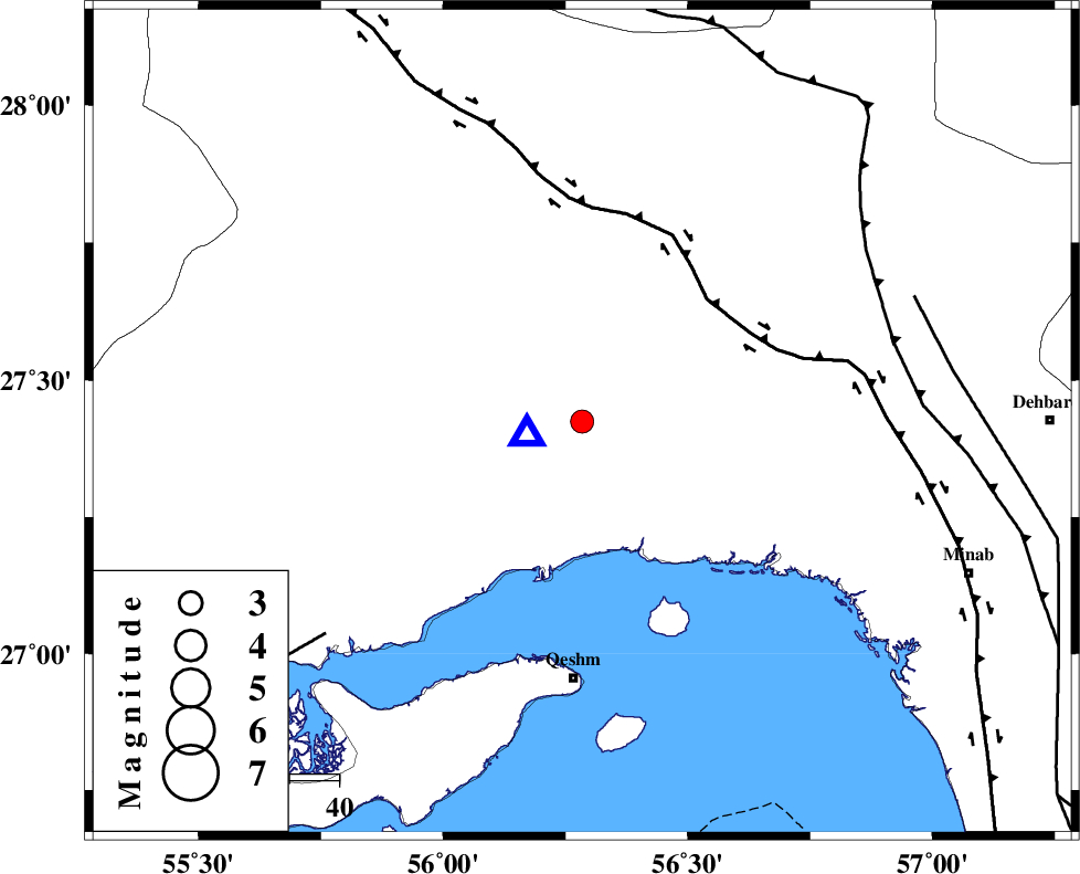
| Location | Lat:27.424 Lon: 56.284 |
| Region | Hormozgan Province, 27 km North of Bandar-e abbas |
Nearest Cities |
|
| 27 km North of Bandar-e abbas, Hormozgan Province | |
| 44 km South East of Fin, Hormozgan Province | |
| 52 km North of Qeshm, Hormozgan Province | |
| 66 km South of Fareqan, Hormozgan Province | |
| 75 km North East of Suza, Hormozgan Province | |
| Depth | 15 km |
| Agency | |
Faults within 150 km: |
|
| HZF2 (Length: 437 km) , Distance to epicenter: 35 km | |
| MAIN_ZAGROS_R_F (Length: 1106 km) , Distance to epicenter: 65 km | |
| MFF1 (Length: 180 km) , Distance to epicenter: 67 km | |
| Number of Phases | 6 |
| RMS | 0.1 |
| Number of Stations | 5 |
| Error in Latitude | >9 km |
| Error in Longitude | 5.3 km |
| Error in Depth | 3.1 km |
Download waveform in seisan format
to download seisan software Click here
to access information about IIEES stations Click here
Amplitude | ||||||||
| UID | Agency | Station | Component | Amplitude | Period | Arrival Time | Proccessing Time | Signal Clip |
| 121299 | IIEES | KRBR | E | 122.3 | 0.56 | 2017-11-08 21:34:50 | 2017-11-12 05:28:00 | n |
| 121300 | IIEES | KRBR | N | 57.4 | 0.45 | 2017-11-08 21:34:50 | 2017-11-12 05:28:00 | n |
| 121301 | IIEES | GHIR | E | 20.3 | 0.68 | 2017-11-08 21:35:16 | 2017-11-12 05:28:00 | n |
| 121302 | IIEES | BSRN | E | 3.7 | 0.7 | 2017-11-08 21:36:16 | 2017-11-12 05:28:00 | n |
Phase | ||||||||||||
| Agency | Station | Component | Phase Type | Phase Quality | First Motion | Observed Arrival Time | Time Residual | Loc. Flag | Input Weight | Distance | Azimuth | |
| IIEES | BNDS | Z | Pg | E | 2017-11-08 21:33:30 | 0.1 | y | 11.5 | 256 | |||
| IIEES | BNDS | N | Sg | E | 2017-11-08 21:33:32 | -0.07 | y | 11.5 | 256 | |||
| IIEES | KRBR | Z | Pn | E | 2017-11-08 21:34:11 | 1.03 | n | 4 | 287 | 9 | ||
| IIEES | GHIR | Z | P | E | 2017-11-08 21:34:16 | -0.03 | y | 339 | 287 | |||
| IIEES | YZKH | Z | Pn | E | 2017-11-08 21:34:46 | 0.1 | y | 574 | 344 | |||
| IIEES | BSRN | Z | Pn | E | 2017-11-08 21:34:45 | -0.11 | y | 574 | 28 | |||