
Magnitude |
2.6 |
| Date & Time (UTC) | 2017-11-15 00:28:13.2 |
| Date & Time (Local) | 1396/8/24 03:58:13.2 |
| Location | Lat:28.91 Lon: 54.289 |
| Region | Fars Province, 33 km South of Neyriz |
Nearest Cities |
|
| 13 km South of Eech, Fars Province | |
| 17 km North of Madoan, Fars Province | |
| 18 km North East of Dogan, Fars Province | |
| 26 km East of Sheshdah, Fars Province | |
| 27 km South West of Hargan, Fars Province | |
| Depth | 14 km |
| Agency | |
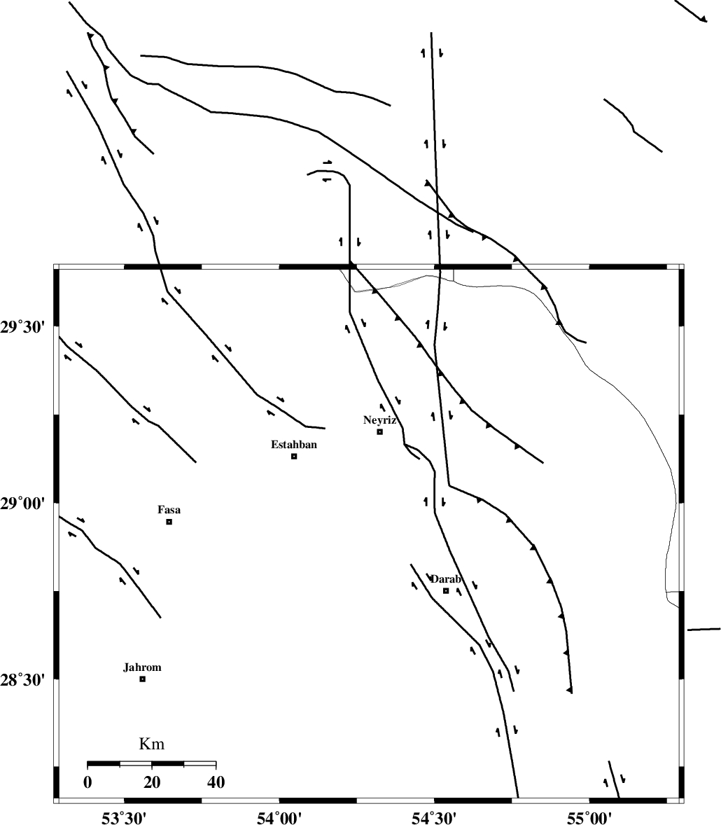
Faults within 150 km: |
|
| HZF1 (Length: 102 km) , Distance to epicenter: 16 km | |
| BAKHTEGAN_F (Length: 94 km) , Distance to epicenter: 20 km | |
| MAIN_ZAGROS_R_F (Length: 1106 km) , Distance to epicenter: 35 km | |
| Number of Phases | 4 |
| RMS | 0.1 |
| Number of Stations | 3 |
| Error in Latitude | >4.6 km |
| Error in Longitude | 3.3 km |
| Error in Depth | 5.3 km |
Download waveform in seisan format
to download seisan software Click here
to access information about IIEES stations Click here
Amplitude | ||||||||
| UID | Agency | Station | Component | Amplitude | Period | Arrival Time | Proccessing Time | Signal Clip |
| 121839 | IIEES | GHIR | E | 87.1 | 0.57 | 2017-11-15 00:29:05 | 2017-11-18 07:31:00 | n |
| 121840 | IIEES | BNDS | E | 20.7 | 0.46 | 2017-11-15 00:29:27 | 2017-11-18 07:31:00 | n |
| 121841 | IIEES | KRBR | N | 34.4 | 0.72 | 2017-11-15 00:29:35 | 2017-11-18 07:31:00 | n |
| 121842 | IIEES | KRBR | E | 23.4 | 0.54 | 2017-11-15 00:29:35 | 2017-11-18 07:31:00 | n |
Phase | ||||||||||||
| Agency | Station | Component | Phase Type | Phase Quality | First Motion | Observed Arrival Time | Time Residual | Loc. Flag | Input Weight | Distance | Azimuth | |
| IIEES | GHIR | Z | Pg | E | 2017-11-15 00:28:37 | -0.06 | y | 145 | 242 | |||
| IIEES | BNDS | Z | Pn | E | 2017-11-15 00:28:51 | 0 | y | 249 | 132 | |||
| IIEES | KRBR | Z | Pn | E | 2017-11-15 00:28:54 | 0.17 | y | 268 | 63 | |||
| IIEES | KRBR | N | Sg | E | 2017-11-15 00:29:28 | -0.11 | y | 268 | 63 | |||