
Magnitude |
2.9 |
| Date & Time (UTC) | 2017-11-23 19:57:59.4 |
| Date & Time (Local) | 1396/9/2 23:27:59.4 |
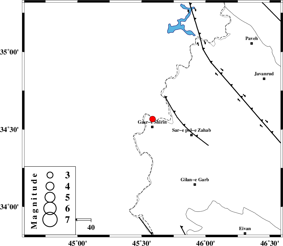
| Location | Lat:34.566 Lon: 45.585 |
| Region | Kermanshah Province, 6 km of Qasr-E-Shirin |
Nearest Cities |
|
| 6 km North of Qasr-E-Shirin, Kermanshah Province | |
| 8 km North of Aqabarar, Kermanshah Province | |
| 14 km North of Seyyed sohrab, Kermanshah Province | |
| 17 km West of Mirmiru, Kermanshah Province | |
| 20 km North West of Qareh belagh, Kermanshah Province | |
| Depth | 14 km |
| Agency | |
Faults within 150 km: |
|
| MFF8 (Length: 48 km) , Distance to epicenter: 16 km | |
| HZF4 (Length: 492 km) , Distance to epicenter: 58 km | |
| ZFF4 (Length: 128 km) , Distance to epicenter: 71 km | |
| Number of Phases | 8 |
| RMS | 0.3 |
| Number of Stations | 6 |
| Error in Latitude | >2.8 km |
| Error in Longitude | 7.2 km |
| Error in Depth | 7.6 km |
Download waveform in seisan format
to download seisan software Click here
to access information about IIEES stations Click here
Amplitude | ||||||||
| UID | Agency | Station | Component | Amplitude | Period | Arrival Time | Proccessing Time | Signal Clip |
| 122467 | IIEES | SNGE | N | 112.7 | 0.39 | 2017-11-23 19:58:51 | 2017-11-25 09:11:00 | n |
| 122468 | IIEES | SNGE | E | 178.7 | 0.44 | 2017-11-23 19:58:52 | 2017-11-25 09:11:00 | n |
Phase | ||||||||||||
| Agency | Station | Component | Phase Type | Phase Quality | First Motion | Observed Arrival Time | Time Residual | Loc. Flag | Input Weight | Distance | Azimuth | |
| IIEES | ILBA | Z | Pg | E | 2017-11-23 19:58:19 | 0.02 | y | 119 | 151 | |||
| IIEES | ILBA | N | Sg | E | 2017-11-23 19:58:34 | 0.08 | y | 119 | 151 | |||
| IIEES | SNGE | Z | Pg | E | 2017-11-23 19:58:27 | -0.3 | y | 171 | 70 | |||
| IIEES | SNGE | N | Sg | E | 2017-11-23 19:58:48 | 0.11 | y | 171 | 70 | |||
| IIEES | ZNJK | Z | Pn | E | 2017-11-23 19:58:53 | 0.6 | y | 365 | 49 | |||
| IIEES | ASAO | Z | Pn | E | 2017-11-23 19:58:57 | -0.37 | y | 408 | 89 | |||
| IIEES | KHMZ | Z | Pn | E | 2017-11-23 19:58:58 | -0.03 | y | 414 | 102 | |||
| IIEES | GRMI | Z | Pn | E | 2017-11-23 19:59:10 | -0.16 | y | 514 | 23 | |||