
Magnitude |
3 |
| Date & Time (UTC) | 2017-12-19 07:09:34.9 |
| Date & Time (Local) | 1396/9/28 10:39:34.9 |
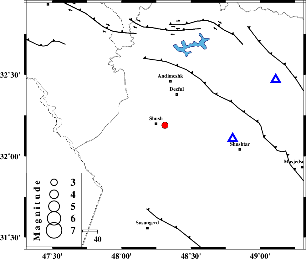
| Location | Lat:32.19 Lon: 48.312 |
| Region | Khoozestan Province, 6 km of Shush |
Nearest Cities |
|
| 3 km North of Amaleh teimur, Khoozestan Province | |
| 6 km of Shush, Khoozestan Province | |
| 16 km South West of Shamsabad, Khoozestan Province | |
| 23 km South of Dezful, Khoozestan Province | |
| 30 km South of Andimeshk, Khoozestan Province | |
| Depth | 15 km |
| Agency | |
Faults within 150 km: |
|
| DEZFUL_EMBAYMENT (Length: 228 km) , Distance to epicenter: 39 km | |
| AHVAZ_F (Length: 99 km) , Distance to epicenter: 59 km | |
| BALARUD_F_Z3 (Length: 53 km) , Distance to epicenter: 65 km | |
| Number of Phases | 6 |
| RMS | 0 |
| Number of Stations | 5 |
| Error in Latitude | >8.3 km |
| Error in Longitude | 1.3 km |
| Error in Depth | 0 km |
Download waveform in seisan format
to download seisan software Click here
to access information about IIEES stations Click here
Amplitude | ||||||||
| UID | Agency | Station | Component | Amplitude | Period | Arrival Time | Proccessing Time | Signal Clip |
| 124786 | IIEES | KHMZ | E | 80 | 0.41 | 2017-12-19 07:10:44 | 2017-12-19 07:33:00 | n |
| 124787 | IIEES | ILBA | N | 78.1 | 0.64 | 2017-12-19 07:11:01 | 2017-12-19 07:33:00 | n |
| 124788 | IIEES | ASAO | N | 63.9 | 0.85 | 2017-12-19 07:11:07 | 2017-12-19 07:33:00 | n |
| 124789 | IIEES | ASAO | E | 37.1 | 0.73 | 2017-12-19 07:11:10 | 2017-12-19 07:33:00 | n |
| 124790 | IIEES | GHVR | E | 37.9 | 0.52 | 2017-12-19 07:11:21 | 2017-12-19 07:33:00 | n |
| 124791 | IIEES | GHVR | N | 34.6 | 0.52 | 2017-12-19 07:11:26 | 2017-12-19 07:33:00 | n |
Phase | ||||||||||||
| Agency | Station | Component | Phase Type | Phase Quality | First Motion | Observed Arrival Time | Time Residual | Loc. Flag | Input Weight | Distance | Azimuth | |
| IIEES | KHMZ | Z | Pn | E | 2017-12-19 07:10:11 | -0.03 | y | 231 | 42 | |||
| IIEES | ILBA | Z | Pn | E | 2017-12-19 07:10:13 | -0.01 | y | 253 | 310 | |||
| IIEES | ASAO | Z | Pn | E | 2017-12-19 07:10:20 | -0.01 | y | 306 | 31 | |||
| IIEES | SNGE | Z | Pn | E | 2017-12-19 07:10:24 | 0.01 | y | 334 | 345 | |||
| IIEES | GHVR | Z | Pn | E | 2017-12-19 07:10:28 | 0.04 | y | 373 | 46 | |||
| IIEES | NASN | Z | Pn | E | 2017-12-19 07:10:33 | -1.94 | n | 4 | 428 | 80 | ||