
Magnitude |
3.3 |
| Date & Time (UTC) | 2017-12-22 21:43:33.7 |
| Date & Time (Local) | 1396/10/2 01:13:33.7 |
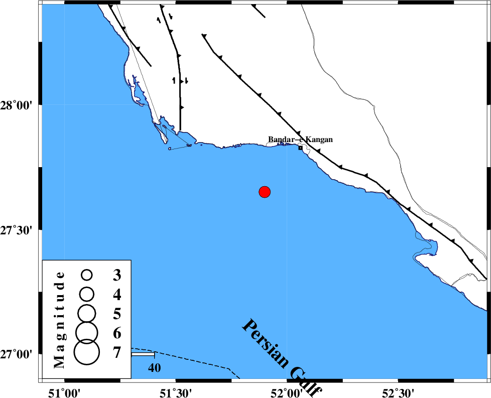
| Location | Lat:27.65 Lon: 51.899 |
| Region | Persian Gulf, 25 km South-West of Bandar-e kangan |
Nearest Cities |
|
| 25 km South West of Bandar-e kangan, Bushehr Province | |
| 44 km West of Bandar-e taheri, Bushehr Province | |
| 46 km South West of Jam, Bushehr Province | |
| 47 km South West of Riz, Bushehr Province | |
| 50 km South East of Abdan, Bushehr Province | |
| Depth | 14 km |
| Agency | |
Faults within 150 km: |
|
| MFF3 (Length: 292 km) , Distance to epicenter: 29 km | |
| BORAZJAN_F (Length: 168 km) , Distance to epicenter: 46 km | |
| ZFF2 (Length: 84 km) , Distance to epicenter: 75 km | |
| Number of Phases | 7 |
| RMS | 0.2 |
| Number of Stations | 4 |
| Error in Latitude | >5.7 km |
| Error in Longitude | 2.9 km |
| Error in Depth | 8.8 km |
Download waveform in seisan format
to download seisan software Click here
to access information about IIEES stations Click here
Amplitude | ||||||||
| UID | Agency | Station | Component | Amplitude | Period | Arrival Time | Proccessing Time | Signal Clip |
| 125253 | IIEES | GHIR | E | 630.4 | 0.59 | 2017-12-22 21:44:15 | 2017-12-23 06:54:00 | n |
| 125254 | IIEES | GHIR | N | 482.8 | 0.29 | 2017-12-22 21:44:17 | 2017-12-23 06:54:00 | n |
| 125255 | IIEES | AHRM | N | 377.7 | 0.48 | 2017-12-22 21:44:17 | 2017-12-23 06:54:00 | n |
| 125256 | IIEES | BNDS | N | 29.3 | 0.4 | 2017-12-22 21:45:29 | 2017-12-23 06:54:00 | n |
| 125257 | IIEES | KRBR | N | 18.7 | 0.59 | 2017-12-22 21:45:48 | 2017-12-23 06:54:00 | n |
| 125258 | IIEES | KRBR | E | 16.1 | 0.68 | 2017-12-22 21:45:53 | 2017-12-23 06:54:00 | n |
Phase | ||||||||||||
| Agency | Station | Component | Phase Type | Phase Quality | First Motion | Observed Arrival Time | Time Residual | Loc. Flag | Input Weight | Distance | Azimuth | |
| IIEES | GHIR | Z | Pg | E | 2017-12-22 21:43:54 | -0.28 | y | 128 | 56 | |||
| IIEES | GHIR | N | Sg | E | 2017-12-22 21:44:11 | 0.17 | y | 128 | 56 | |||
| IIEES | AHRM | N | Pg | E | 2017-12-22 21:43:58 | 0.13 | y | 147 | 336 | |||
| IIEES | AHRM | E | Sg | E | 2017-12-22 21:44:15 | -0.03 | y | 147 | 336 | |||
| IIEES | BNDS | Z | Pn | E | 2017-12-22 21:44:34 | 0.25 | y | 423 | 93 | |||
| IIEES | KRBR | Z | Pn | E | 2017-12-22 21:44:48 | -0.29 | y | 540 | 60 | |||
| IIEES | YZKH | Z | Pn | E | 2017-12-22 21:44:53 | -1.26 | n | 4 | 586 | 26 | ||