
Magnitude |
2.5 |
| Date & Time (UTC) | 2018-01-13 04:17:29.4 |
| Date & Time (Local) | 1396/10/23 07:47:29.4 |
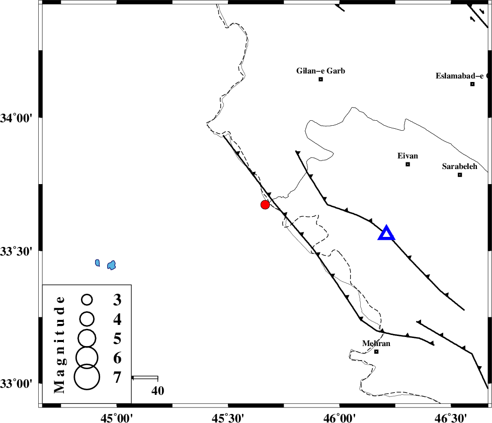
| Location | Lat:33.673 Lon: 45.666 |
| Region | Iraq, 57 km South-West of Gilan-E-Gharb |
Nearest Cities |
|
| 23 km South of Sumar, Kermanshah Province | |
| 48 km South West of Nian, Kermanshah Province | |
| 52 km South West of Teran, Ilam Province | |
| 53 km North West of Salehabad, Ilam Province | |
| 55 km South West of Zarneh, Ilam Province | |
| Depth | 14 km |
| Agency | |
Faults within 150 km: |
|
| ZFF4 (Length: 128 km) , Distance to epicenter: 4 km | |
| MFF7 (Length: 99 km) , Distance to epicenter: 22 km | |
| MFF6 (Length: 144 km) , Distance to epicenter: 80 km | |
| Number of Phases | 6 |
| RMS | 0.1 |
| Number of Stations | 4 |
| Error in Latitude | >2.3 km |
| Error in Longitude | 5.9 km |
| Error in Depth | 6 km |
Download waveform in seisan format
to download seisan software Click here
to access information about IIEES stations Click here
Amplitude | ||||||||
| UID | Agency | Station | Component | Amplitude | Period | Arrival Time | Proccessing Time | Signal Clip |
| 126687 | IIEES | ILBA | N | 319.7 | 0.22 | 2018-01-13 04:17:46 | 2018-01-13 07:54:00 | n |
| 126688 | IIEES | SNGE | E | 49.2 | 0.61 | 2018-01-13 04:18:36 | 2018-01-13 07:54:00 | n |
| 126689 | IIEES | SNGE | N | 58.9 | 0.49 | 2018-01-13 04:18:38 | 2018-01-13 07:54:00 | n |
| 126690 | IIEES | KHMZ | E | 4.7 | 0.44 | 2018-01-13 04:19:32 | 2018-01-13 07:54:00 | n |
| 126691 | IIEES | ASAO | N | 4.1 | 0.54 | 2018-01-13 04:19:36 | 2018-01-13 07:54:00 | n |
Phase | ||||||||||||
| Agency | Station | Component | Phase Type | Phase Quality | First Motion | Observed Arrival Time | Time Residual | Loc. Flag | Input Weight | Distance | Azimuth | |
| IIEES | ILBA | Z | Pg | E | 2018-01-13 04:17:38 | -0.13 | y | 50.5 | 96 | |||
| IIEES | ILBA | N | Sg | E | 2018-01-13 04:17:45 | 0.02 | y | 50.5 | 96 | |||
| IIEES | SNGE | Z | Pn | E | 2018-01-13 04:18:04 | -0.15 | y | 221 | 44 | |||
| IIEES | SNGE | N | Sg | E | 2018-01-13 04:18:32 | 0.04 | y | 221 | 44 | |||
| IIEES | KHMZ | Z | Pn | E | 2018-01-13 04:18:26 | 0.13 | y | 398 | 88 | |||
| IIEES | ASAO | Z | Pn | E | 2018-01-13 04:18:28 | 0.17 | y | 414 | 75 | |||