
Magnitude |
2.5 |
| Date & Time (UTC) | 2018-02-05 00:33:20.4 |
| Date & Time (Local) | 1396/11/16 04:03:20.4 |
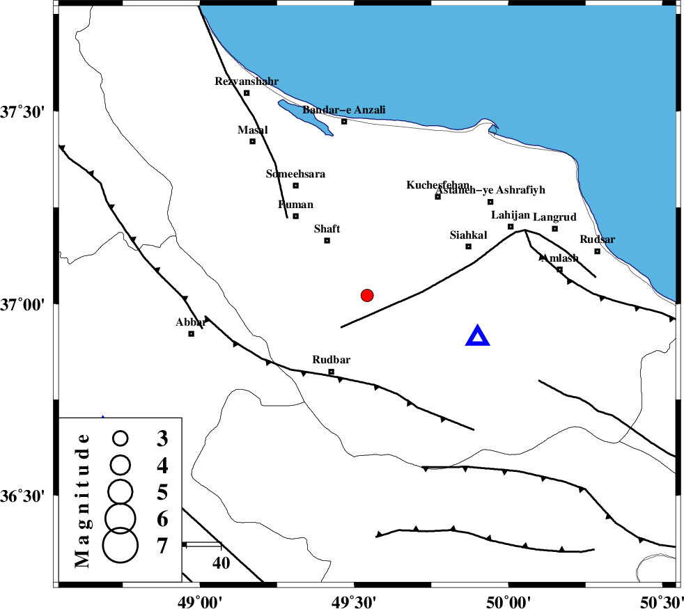
| Location | Lat:37.022 Lon: 49.542 |
| Region | Gilan Province, 20 km South-East of Shaft |
Nearest Cities |
|
| 6 km North of Nasir mahalleh, Gilan Province | |
| 7 km of Eskolak, Gilan Province | |
| 9 km North of Shahr-e bijar, Gilan Province | |
| 10 km of Jirdeh, Gilan Province | |
| 12 km West of Saravan, Gilan Province | |
| Depth | 15 km |
| Agency | |
Faults within 150 km: |
|
| LAHIJAN_F (Length: 92 km) , Distance to epicenter: 12 km | |
| RUDBAR_F (Length: 93 km) , Distance to epicenter: 25 km | |
| TALESH_F (Length: 258 km) , Distance to epicenter: 32 km | |
| Number of Phases | 8 |
| RMS | 0.4 |
| Number of Stations | 7 |
| Error in Latitude | >5.7 km |
| Error in Longitude | 5.1 km |
| Error in Depth | 8.6 km |
Download waveform in seisan format
to download seisan software Click here
to access information about IIEES stations Click here
Amplitude | ||||||||
| UID | Agency | Station | Component | Amplitude | Period | Arrival Time | Proccessing Time | Signal Clip |
| 127871 | IIEES | THKV | N | 51.9 | 0.2 | 2018-02-05 00:34:12 | 2018-02-05 06:05:00 | n |
Phase | ||||||||||||
| Agency | Station | Component | Phase Type | Phase Quality | First Motion | Observed Arrival Time | Time Residual | Loc. Flag | Input Weight | Distance | Azimuth | |
| IIEES | GIDE | Z | Pg | E | 2018-02-05 00:33:26 | -0.56 | y | 34.6 | 108 | |||
| IIEES | ZNJK | Z | Pg | E | 2018-02-05 00:33:34 | -0.7 | y | 85.8 | 243 | |||
| IIEES | THKV | Z | Pg | E | 2018-02-05 00:33:49 | 0.25 | y | 172 | 135 | |||
| IIEES | THKV | N | Sg | E | 2018-02-05 00:34:09 | 0.22 | y | 172 | 135 | |||
| IIEES | CHTH | Z | Pg | E | 2018-02-05 00:33:51 | -0.26 | y | 188 | 131 | |||
| IIEES | GRMI | Z | Pn | E | 2018-02-05 00:33:58 | 0.37 | y | 246 | 324 | |||
| IIEES | ASAO | Z | Pn | E | 2018-02-05 00:34:03 | 0.3 | y | 278 | 171 | |||
| IIEES | SNGE | Z | Pn | E | 2018-02-05 00:34:04 | 0.43 | y | 291 | 223 | |||