
Magnitude |
2.7 |
| Date & Time (UTC) | 2018-01-30 23:59:12.0 |
| Date & Time (Local) | 1396/11/11 03:29:12.0 |
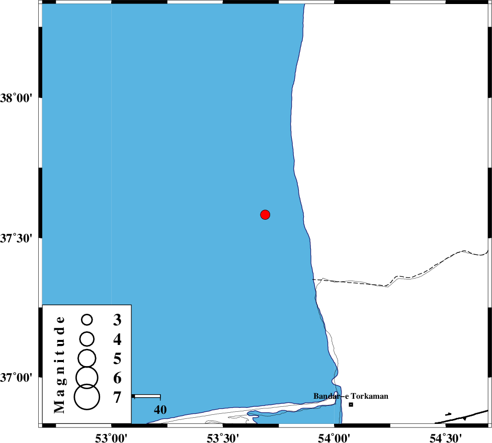
| Location | Lat:37.582 Lon: 53.689 |
| Region | Caspian Sea |
Nearest Cities |
|
| 64 km North West of Gomishtappeh, Golestan Province | |
| 80 km North West of Banavar, Golestan Province | |
| 83 km North West of Bandar-e torkaman, Golestan Province | |
| 87 km North West of Sijval, Golestan Province | |
| 92 km North East of Zaghmarz, Mazandaran Province | |
| Depth | 15 km |
| Agency | |
Faults within 150 km: |
|
| KHAZAR_F (Length: 523 km) , Distance to epicenter: 96 km | |
| N_ALBORZ_F (Length: 360 km) , Distance to epicenter: 122 km | |
| SHAVAR_F (Length: 87 km) , Distance to epicenter: 129 km | |
| Number of Phases | 7 |
| RMS | 0.4 |
| Number of Stations | 7 |
| Error in Latitude | >7.7 km |
| Error in Longitude | 2.2 km |
| Error in Depth | 0 km |
Download waveform in seisan format
to download seisan software Click here
to access information about IIEES stations Click here
Amplitude | ||||||||
| UID | Agency | Station | Component | Amplitude | Period | Arrival Time | Proccessing Time | Signal Clip |
| 128408 | IIEES | MRVT | E | 51.9 | 0.25 | 2018-01-31 00:00:10 | 2018-02-14 08:48:00 | n |
| 128409 | IIEES | BJRD | E | 17.5 | 0.26 | 2018-01-31 00:00:37 | 2018-02-14 08:48:00 | n |
| 128410 | IIEES | BJRD | N | 18 | 0.41 | 2018-01-31 00:00:38 | 2018-02-14 08:48:00 | n |
| 128411 | IIEES | GIDE | E | 20.1 | 0.57 | 2018-01-31 00:01:14 | 2018-02-14 08:48:00 | n |
| 128412 | IIEES | TABS | N | 3 | 0.43 | 2018-01-31 00:01:53 | 2018-02-14 08:48:00 | n |
Phase | ||||||||||||
| Agency | Station | Component | Phase Type | Phase Quality | First Motion | Observed Arrival Time | Time Residual | Loc. Flag | Input Weight | Distance | Azimuth | |
| IIEES | MRVT | Z | Pn | E | 2018-01-30 23:59:46 | 0.45 | y | 212 | 87 | |||
| IIEES | DAMV | Z | Pn | E | 2018-01-30 23:59:53 | 0.35 | y | 266 | 216 | |||
| IIEES | SHRO | Z | Pn | E | 2018-01-30 23:59:52 | -0.57 | y | 271 | 129 | |||
| IIEES | CHTH | Z | Pn | E | 2018-01-30 23:59:56 | -0.17 | y | 295 | 232 | |||
| IIEES | BJRD | Z | Pn | E | 2018-01-31 00:00:00 | -0.25 | y | 329 | 87 | |||
| IIEES | GIDE | Z | Pn | E | 2018-01-31 00:00:02 | -0.14 | y | 343 | 259 | |||
| IIEES | TABS | Z | Pn | E | 2018-01-31 00:00:26 | 0.41 | y | 536 | 144 | |||