
Magnitude |
2.6 |
| Date & Time (UTC) | 2018-02-17 08:17:38.1 |
| Date & Time (Local) | 1396/11/28 11:47:38.1 |
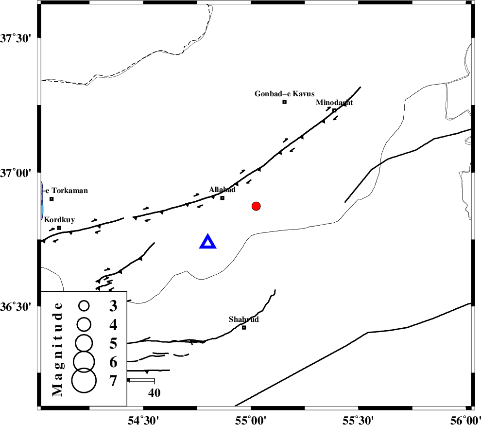
| Location | Lat:36.874 Lon: 55.024 |
| Region | Golestan Province, 14 km -East of Ali Abad |
Nearest Cities |
|
| 14 km East of Ali Abad, Golestan Province | |
| 16 km South of Khanbebin, Golestan Province | |
| 18 km South of Deland, Golestan Province | |
| 19 km South West of Ramian, Golestan Province | |
| 27 km South West of Khanduz, Golestan Province | |
| Depth | 16 km |
| Agency | |
Faults within 150 km: |
|
| KHAZAR_F (Length: 523 km) , Distance to epicenter: 16 km | |
| SHAVAR_F (Length: 87 km) , Distance to epicenter: 17 km | |
| ROBATE_QARABIL_F (Length: 168 km) , Distance to epicenter: 37 km | |
| Number of Phases | 8 |
| RMS | 0.4 |
| Number of Stations | 7 |
| Error in Latitude | >3.7 km |
| Error in Longitude | 6 km |
| Error in Depth | 9.1 km |
Download waveform in seisan format
to download seisan software Click here
to access information about IIEES stations Click here
Amplitude | ||||||||
| UID | Agency | Station | Component | Amplitude | Period | Arrival Time | Proccessing Time | Signal Clip |
| 128682 | IIEES | MRVT | E | 166.2 | 0.4 | 2018-02-17 08:18:21 | 2018-02-18 06:52:00 | n |
| 128683 | IIEES | MRVT | N | 125.1 | 0.24 | 2018-02-17 08:18:22 | 2018-02-18 06:52:00 | n |
| 128684 | IIEES | BJRD | N | 36.6 | 0.34 | 2018-02-17 08:18:49 | 2018-02-18 06:52:00 | n |
| 128685 | IIEES | BJRD | E | 36.3 | 0.27 | 2018-02-17 08:18:54 | 2018-02-18 06:52:00 | n |
Phase | ||||||||||||
| Agency | Station | Component | Phase Type | Phase Quality | First Motion | Observed Arrival Time | Time Residual | Loc. Flag | Input Weight | Distance | Azimuth | |
| IIEES | MRVT | Z | Pg | E | 2018-02-17 08:17:59 | 0.05 | y | 129 | 47 | |||
| IIEES | SHRO | Z | Pg | E | 2018-02-17 08:18:00 | 0.16 | y | 131 | 137 | |||
| IIEES | SHRO | E | Sg | E | 2018-02-17 08:18:15 | -0.21 | y | 131 | 137 | |||
| IIEES | BJRD | Z | Pn | E | 2018-02-17 08:18:14 | 0.07 | y | 231 | 66 | |||
| IIEES | CHTH | Z | Pn | E | 2018-02-17 08:18:31 | 0.51 | y | 366 | 254 | |||
| IIEES | TABS | Z | Pn | E | 2018-02-17 08:18:35 | -0.33 | y | 405 | 151 | |||
| IIEES | BSRN | Z | Pn | E | 2018-02-17 08:19:08 | 0.49 | y | 662 | 144 | |||
| IIEES | GRMI | Z | Pn | E | 2018-02-17 08:19:07 | -1 | y | 663 | 291 | |||