
Magnitude |
3.3 |
| Date & Time (UTC) | 2018-03-28 12:10:08.0 |
| Date & Time (Local) | 1397/1/8 16:40:08.0 |
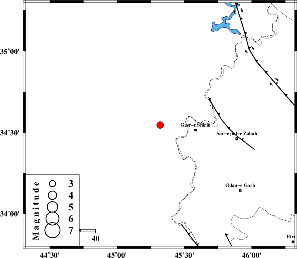
| Location | Lat:34.547 Lon: 45.319 |
| Region | Iraq, 24 km -West of Qasr-E-Shirin |
Nearest Cities |
|
| 22 km North West of Khosravi, Kermanshah Province | |
| 24 km North West of Qasr-E-Shirin, Kermanshah Province | |
| 28 km North West of Seyyed sohrab, Kermanshah Province | |
| 32 km North West of Aqabarar, Kermanshah Province | |
| 41 km West of Mirmiru, Kermanshah Province | |
| Depth | 14 km |
| Agency | |
Faults within 150 km: |
|
| MFF8 (Length: 48 km) , Distance to epicenter: 38 km | |
| ZFF4 (Length: 128 km) , Distance to epicenter: 70 km | |
| HZF4 (Length: 492 km) , Distance to epicenter: 79 km | |
| Number of Phases | 7 |
| RMS | 0.1 |
| Number of Stations | 6 |
| Error in Latitude | >2.2 km |
| Error in Longitude | 9.9 km |
| Error in Depth | 4.4 km |
Download waveform in seisan format
to download seisan software Click here
to access information about IIEES stations Click here
Amplitude | ||||||||
| UID | Agency | Station | Component | Amplitude | Period | Arrival Time | Proccessing Time | Signal Clip |
| 131693 | IIEES | ILBA | N | 981.4 | 0.33 | 2018-03-28 12:10:51 | 2018-05-16 07:20:00 | n |
| 131694 | IIEES | ILBA | E | 1062.6 | 0.43 | 2018-03-28 12:10:53 | 2018-05-16 07:20:00 | n |
| 131695 | IIEES | ASAO | N | 19.8 | 0.7 | 2018-03-28 12:11:59 | 2018-05-16 07:20:00 | n |
| 131696 | IIEES | ASAO | E | 25.5 | 0.64 | 2018-03-28 12:12:02 | 2018-05-16 07:20:00 | n |
| 131697 | IIEES | GHVR | N | 9.4 | 0.53 | 2018-03-28 12:12:50 | 2018-05-16 07:20:00 | n |
| 131698 | IIEES | GHVR | E | 17.7 | 0.53 | 2018-03-28 12:12:52 | 2018-05-16 07:20:00 | n |
Phase | ||||||||||||
| Agency | Station | Component | Phase Type | Phase Quality | First Motion | Observed Arrival Time | Time Residual | Loc. Flag | Input Weight | Distance | Azimuth | |
| IIEES | ILBA | Z | Pg | E | 2018-03-28 12:10:29 | -0.06 | y | 131 | 141 | |||
| IIEES | ILBA | N | Sg | E | 2018-03-28 12:10:45 | 0 | y | 131 | 141 | |||
| IIEES | SNGE | Z | Pg | E | 2018-03-28 12:10:40 | -0.09 | y | 195 | 71 | |||
| IIEES | ASAO | Z | Pn | E | 2018-03-28 12:11:09 | 0.33 | y | 432 | 89 | |||
| IIEES | KHMZ | Z | Pn | E | 2018-03-28 12:11:10 | -0.01 | y | 438 | 101 | |||
| IIEES | GHVR | Z | Pn | E | 2018-03-28 12:11:23 | 0.06 | y | 544 | 89 | |||
| IIEES | CHTH | Z | Pn | E | 2018-03-28 12:11:23 | -0.2 | y | 550 | 72 | |||