
Magnitude |
2.6 |
| Date & Time (UTC) | 2018-03-29 18:22:09.6 |
| Date & Time (Local) | 1397/1/9 22:52:09.6 |
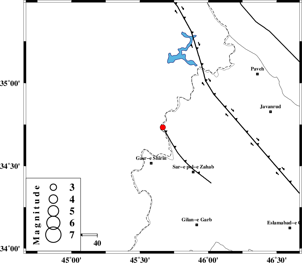
| Location | Lat:34.733 Lon: 45.667 |
| Region | Kermanshah Province, 16 km -West of Tazehabad |
Nearest Cities |
|
| 6 km of Tappeh rash, Kermanshah Province | |
| 13 km North West of Gardehnu, Kermanshah Province | |
| 16 km West of Tazehabad, Kermanshah Province | |
| 21 km North of Mirmiru, Kermanshah Province | |
| 21 km North of Aqabarar, Kermanshah Province | |
| Depth | 14 km |
| Agency | |
Faults within 150 km: |
|
| MFF8 (Length: 48 km) , Distance to epicenter: 2 km | |
| HZF4 (Length: 492 km) , Distance to epicenter: 41 km | |
| ZFF4 (Length: 128 km) , Distance to epicenter: 91 km | |
| Number of Phases | 5 |
| RMS | 0.1 |
| Number of Stations | 4 |
| Error in Latitude | >2.3 km |
| Error in Longitude | 9.2 km |
| Error in Depth | 4.2 km |
Download waveform in seisan format
to download seisan software Click here
to access information about IIEES stations Click here
Amplitude | ||||||||
| UID | Agency | Station | Component | Amplitude | Period | Arrival Time | Proccessing Time | Signal Clip |
| 131986 | IIEES | ILBA | N | 388.4 | 0.23 | 2018-03-29 18:22:52 | 2018-05-20 08:50:00 | n |
| 131987 | IIEES | ILBA | E | 411.2 | 0.42 | 2018-03-29 18:22:53 | 2018-05-20 08:50:00 | n |
Phase | ||||||||||||
| Agency | Station | Component | Phase Type | Phase Quality | First Motion | Observed Arrival Time | Time Residual | Loc. Flag | Input Weight | Distance | Azimuth | |
| IIEES | ILBA | Z | Pg | E | 2018-03-29 18:22:31 | -0.01 | y | 133 | 158 | |||
| IIEES | SNGE | Z | Pg | E | 2018-03-29 18:22:35 | -0.02 | y | 159 | 75 | |||
| IIEES | ILBA | N | Sg | E | 2018-03-29 18:22:47 | y | 133 | 158 | ||||
| IIEES | ASAO | Z | Pn | E | 2018-03-29 18:23:07 | 0.16 | y | 400 | 92 | |||
| IIEES | KHMZ | Z | Pn | E | 2018-03-29 18:23:08 | y | 411 | 104 | ||||