
Magnitude |
3.8 |
| Date & Time (UTC) | 2018-07-12 21:59:33.4 |
| Date & Time (Local) | 1397/4/22 02:29:33.4 |
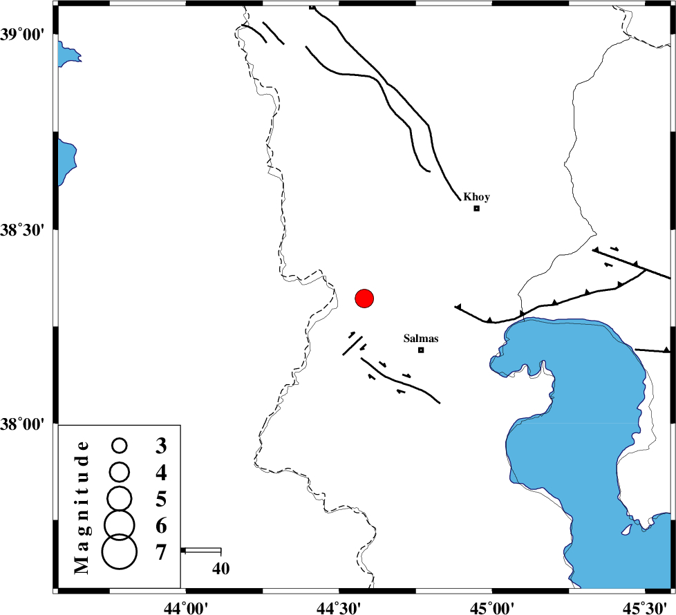
| Location | Lat:38.322 Lon: 44.582 |
| Region | Azarbaijan Gharbi Province, 22 km North-West of Salmas |
Nearest Cities |
|
| 15 km North West of Saylab, Azarbaijan Gharbi Province | |
| 17 km North of Tazehshahr, Azarbaijan Gharbi Province | |
| 22 km North East of Kuzeh rash, Azarbaijan Gharbi Province | |
| 22 km North West of Salmas, Azarbaijan Gharbi Province | |
| 22 km South East of Gatur, Azarbaijan Gharbi Province | |
| Depth | 17 km |
| Agency | |
Faults within 150 km: |
|
| SALMAS (Length: 20 km) , Distance to epicenter: 11 km | |
| N_TABRIZ_F3 (Length: 66 km) , Distance to epicenter: 26 km | |
| KHOY (Length: 100 km) , Distance to epicenter: 39 km | |
| Number of Phases | 8 |
| RMS | 0.1 |
| Number of Stations | 5 |
| Error in Latitude | >1.1 km |
| Error in Longitude | 2.6 km |
| Error in Depth | 0 km |
Download waveform in seisan format
to download seisan software Click here
to access information about IIEES stations Click here
Amplitude | ||||||||
| UID | Agency | Station | Component | Amplitude | Period | Arrival Time | Proccessing Time | Signal Clip |
| 134430 | IIEES | MAKU | N | 1671.5 | 0.05 | 2018-07-12 22:00:10 | 2018-07-14 04:19:00 | n |
| 134431 | IIEES | GRMI | N | 230.9 | 0.5 | 2018-07-12 22:00:55 | 2018-07-14 04:19:00 | n |
| 134432 | IIEES | GIDE | E | 79.3 | 0.56 | 2018-07-12 22:02:03 | 2018-07-14 04:19:00 | n |
| 134433 | IIEES | GIDE | N | 110.7 | 0.63 | 2018-07-12 22:02:04 | 2018-07-14 04:19:00 | n |
| 134434 | IIEES | ILBA | N | 39.4 | 0.79 | 2018-07-12 22:02:25 | 2018-07-14 04:19:00 | n |
Phase | ||||||||||||
| Agency | Station | Component | Phase Type | Phase Quality | First Motion | Observed Arrival Time | Time Residual | Loc. Flag | Input Weight | Distance | Azimuth | |
| IIEES | MAKU | Z | Pg | E | 2018-07-12 21:59:52 | 0.12 | y | 115 | 4 | |||
| IIEES | MAKU | N | Sg | E | 2018-07-12 22:00:06 | -0.09 | y | 115 | 4 | |||
| IIEES | GRMI | Z | Pn | E | 2018-07-12 22:00:17 | 0 | y | 294 | 78 | |||
| IIEES | GRMI | N | S | E | 2018-07-12 22:00:49 | 0.04 | y | 294 | 78 | |||
| IIEES | ZNJK | Z | Pn | E | 2018-07-12 22:00:31 | -0.09 | y | 406 | 116 | |||
| IIEES | SNGE | Z | Pn | E | 2018-07-12 22:00:24 | -10.8 | n | 4 | 435 | 145 | ||
| IIEES | GIDE | Z | Pn | E | 2018-07-12 22:00:51 | 9.04 | n | 4 | 495 | 107 | ||
| IIEES | ILBA | Z | Pn | E | 2018-07-12 22:00:51 | 3.09 | n | 4 | 541 | 164 | ||