
Magnitude |
2.6 |
| Date & Time (UTC) | 2018-07-25 17:55:00.5 |
| Date & Time (Local) | 1397/5/3 22:25:00.5 |
| Location | Lat:35.767 Lon: 60.388 |
| Region | Khorasan(center) Province, 49 km -East of Fariman |
Nearest Cities |
|
| 24 km South East of Kalateh menar, Khorasan(center) Province | |
| 28 km North West of Musaabad, Khorasan(center) Province | |
| 30 km North East of Sefidsang, Khorasan(center) Province | |
| 40 km North of Nasrabad, Khorasan(center) Province | |
| 42 km North East of Galandarabad, Khorasan(center) Province | |
| Depth | 13 km |
| Agency | |
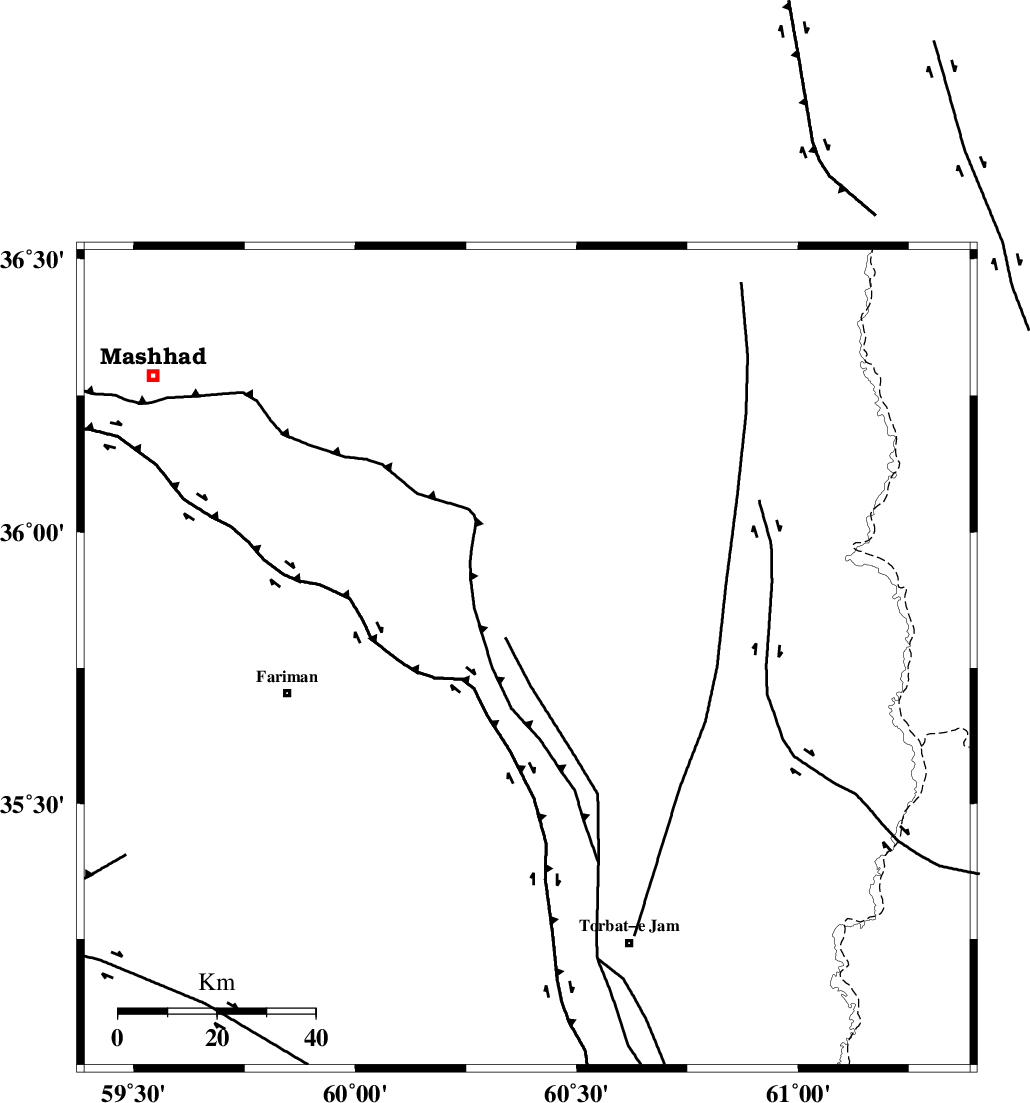
Faults within 150 km: |
|
| BINALUD_F1 (Length: 178 km) , Distance to epicenter: 16 km | |
| TORBAT_E_JAM_F1 (Length: 71 km) , Distance to epicenter: 44 km | |
| TORBAT_E_JAM_F2 (Length: 57 km) , Distance to epicenter: 46 km | |
| Number of Phases | 6 |
| RMS | 0.5 |
| Number of Stations | 6 |
| Error in Latitude | >7.8 km |
| Error in Longitude | 6 km |
| Error in Depth | 0 km |
Download waveform in seisan format
to download seisan software Click here
to access information about IIEES stations Click here
Amplitude | ||||||||
| UID | Agency | Station | Component | Amplitude | Period | Arrival Time | Proccessing Time | Signal Clip |
| 135427 | IIEES | TABS | N | 10.3 | 0.4 | 2018-07-25 17:56:56 | 2018-08-01 06:47:00 | n |
Phase | ||||||||||||
| Agency | Station | Component | Phase Type | Phase Quality | First Motion | Observed Arrival Time | Time Residual | Loc. Flag | Input Weight | Distance | Azimuth | |
| IIEES | SHRT | Z | Pn | E | 2018-07-25 17:55:37 | -0.3 | y | 235 | 182 | |||
| IIEES | BJRD | Z | Pn | E | 2018-07-25 17:55:51 | 0.66 | y | 342 | 310 | |||
| IIEES | TABS | Z | Pn | E | 2018-07-25 17:55:55 | 0.24 | y | 381 | 233 | |||
| IIEES | SHRO | Z | Pn | E | 2018-07-25 17:55:57 | -0.21 | y | 396 | 275 | |||
| IIEES | BSRN | Z | Pn | E | 2018-07-25 17:56:03 | 0.35 | y | 437 | 196 | |||
| IIEES | MRVT | Z | Pn | E | 2018-07-25 17:56:01 | -0.75 | y | 438 | 300 | |||

 IIEES All Rights Reserved