
Magnitude |
4 |
| Date & Time (UTC) | 2018-09-06 21:23:44.6 |
| Date & Time (Local) | 1397/6/16 01:53:44.6 |
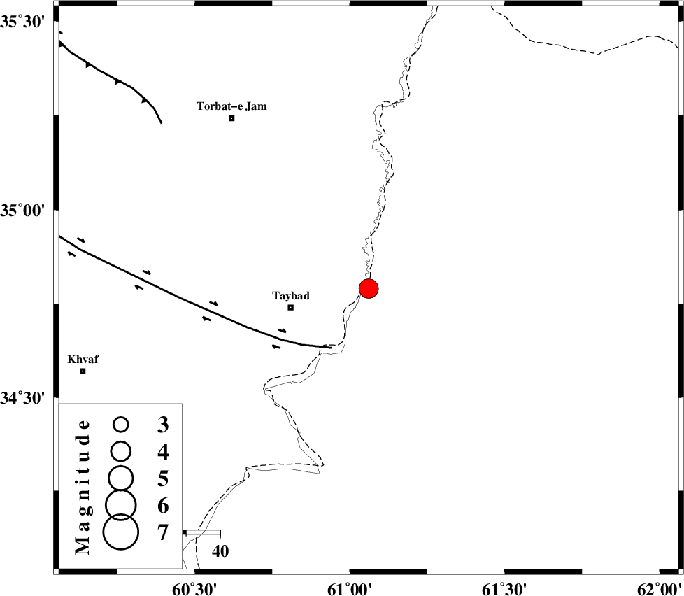
| Location | Lat:34.79 Lon: 61.061 |
| Region | , 24 km -East of Taybad |
Nearest Cities |
|
| 22 km East of Void, Khorasan(center) Province | |
| 24 km North East of Taybad, Khorasan(center) Province | |
| 41 km South East of Samieabad, Khorasan(center) Province | |
| 51 km East of Mashhad rizeh, Khorasan(center) Province | |
| 52 km North East of Karat, Khorasan(center) Province | |
| Depth | 18 km |
| Agency | |
Faults within 150 km: |
|
| DORUNEH_F (Length: 713 km) , Distance to epicenter: 21 km | |
| TORBAT_E_JAM_F2 (Length: 57 km) , Distance to epicenter: 78 km | |
| DASHT_E_BAYAZ_F (Length: 177 km) , Distance to epicenter: 91 km | |
| Number of Phases | 5 |
| RMS | 0 |
| Number of Stations | 4 |
| Error in Latitude | >5.5 km |
| Error in Longitude | 8.4 km |
| Error in Depth | 4.9 km |
Download waveform in seisan format
to download seisan software Click here
to access information about IIEES stations Click here
Amplitude | ||||||||
| UID | Agency | Station | Component | Amplitude | Period | Arrival Time | Proccessing Time | Signal Clip |
| 136491 | IIEES | SHRT | N | 2521.7 | 0.33 | 2018-09-06 21:24:37 | 2018-09-08 06:17:00 | n |
Phase | ||||||||||||
| Agency | Station | Component | Phase Type | Phase Quality | First Motion | Observed Arrival Time | Time Residual | Loc. Flag | Input Weight | Distance | Azimuth | |
| IIEES | SHRT | Z | Pg | E | 2018-09-06 21:24:08 | 0.07 | y | 145 | 209 | |||
| IIEES | SHRT | N | Sg | E | 2018-09-06 21:24:26 | -0.02 | y | 145 | 209 | |||
| IIEES | BSRN | Z | Pn | E | 2018-09-06 21:24:36 | 0 | y | 361 | 210 | |||
| IIEES | ZHSF | Z | Pn | E | 2018-09-06 21:25:03 | -0.02 | y | 575 | 183 | |||
| IIEES | KRBR | Z | Pn | E | 2018-09-06 21:25:15 | -0.08 | y | 669 | 218 | |||