
Magnitude |
2.5 |
| Date & Time (UTC) | 2018-10-27 19:48:28.3 |
| Date & Time (Local) | 1397/8/5 23:18:28.3 |
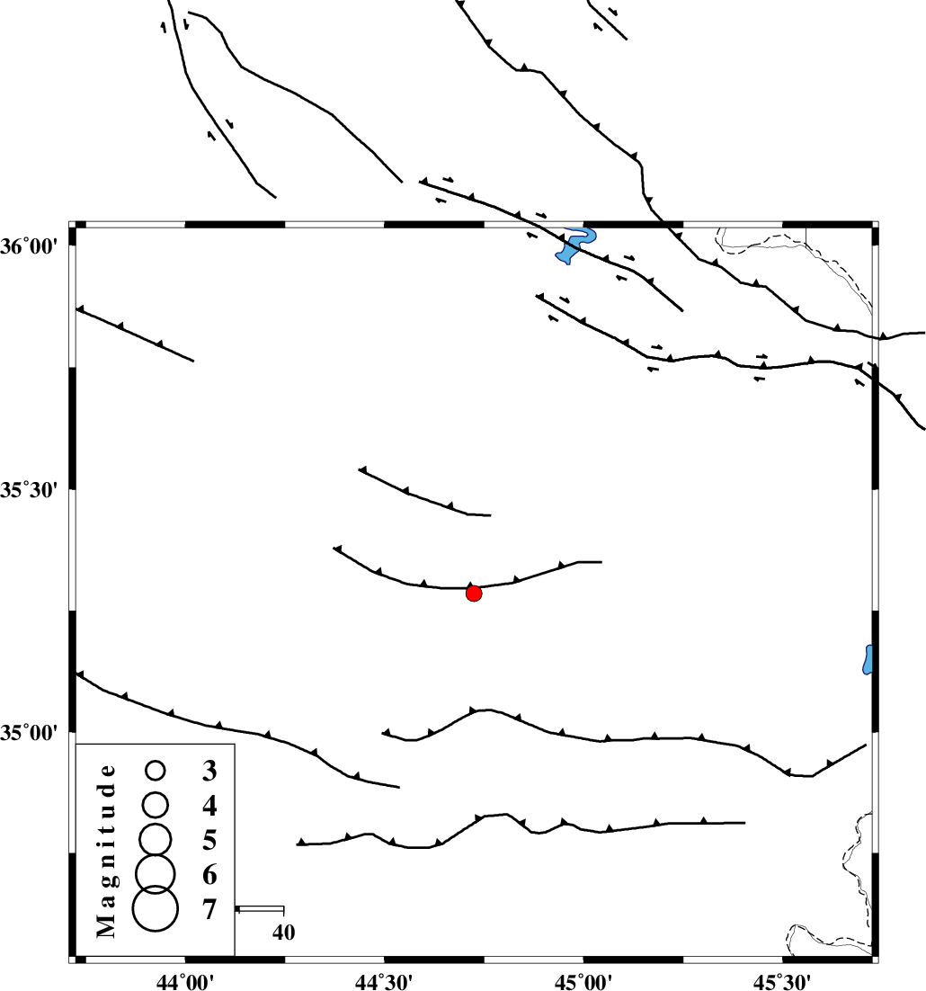
| Location | Lat:35.285 Lon: 44.724 |
| Region | Iraq, 72 km South-West of Sulaymaniyah |
Nearest Cities |
|
| 72 km South West of Sulaymaniyah, Iraq Province | |
| 108 km North West of Tappeh rash, Kermanshah Province | |
| 113 km South West of Balekeh, Kurdistan Province | |
| 114 km North West of Markhil, Kermanshah Province | |
| 115 km South West of Bivaran-e sofla, Azarbaijan Gharbi Province | |
| Depth | 14 km |
| Agency | |
Faults within 150 km: |
|
| HZF4 (Length: 492 km) , Distance to epicenter: 91 km | |
| MFF8 (Length: 48 km) , Distance to epicenter: 108 km | |
| PIRANSHAHR_F (Length: 253 km) , Distance to epicenter: 119 km | |
| Number of Phases | 6 |
| RMS | 0.2 |
| Number of Stations | 3 |
| Error in Latitude | >1.7 km |
| Error in Longitude | 5.2 km |
| Error in Depth | 6.2 km |
Download waveform in seisan format
to download seisan software Click here
to access information about IIEES stations Click here
Amplitude | ||||||||
| UID | Agency | Station | Component | Amplitude | Period | Arrival Time | Proccessing Time | Signal Clip |
| 138094 | IIEES | ILBA | N | 28.4 | 0.52 | 2018-10-27 19:49:47 | 2018-10-28 08:21:00 | n |
Phase | ||||||||||||
| Agency | Station | Component | Phase Type | Phase Quality | First Motion | Observed Arrival Time | Time Residual | Loc. Flag | Input Weight | Distance | Azimuth | |
| IIEES | SRSL | Z | Pg | E | 2018-10-27 19:48:48 | -0.26 | y | 121 | 32 | |||
| IIEES | SRSL | N | Sg | E | 2018-10-27 19:49:03 | 0.03 | y | 121 | 32 | |||
| IIEES | ILBA | Z | Pn | E | 2018-10-27 19:49:04 | 0.22 | y | 229 | 143 | |||
| IIEES | ILBA | N | Sg | E | 2018-10-27 19:49:32 | -0.28 | y | 229 | 143 | |||
| IIEES | SNGE | Z | Pn | E | 2018-10-27 19:49:06 | 0.17 | y | 240 | 94 | |||
| IIEES | SNGE | N | Sg | E | 2018-10-27 19:49:36 | 0.12 | y | 240 | 94 | |||