
Magnitude |
3.1 |
| Date & Time (UTC) | 2018-11-30 17:02:59.6 |
| Date & Time (Local) | 1397/9/9 20:32:59.6 |
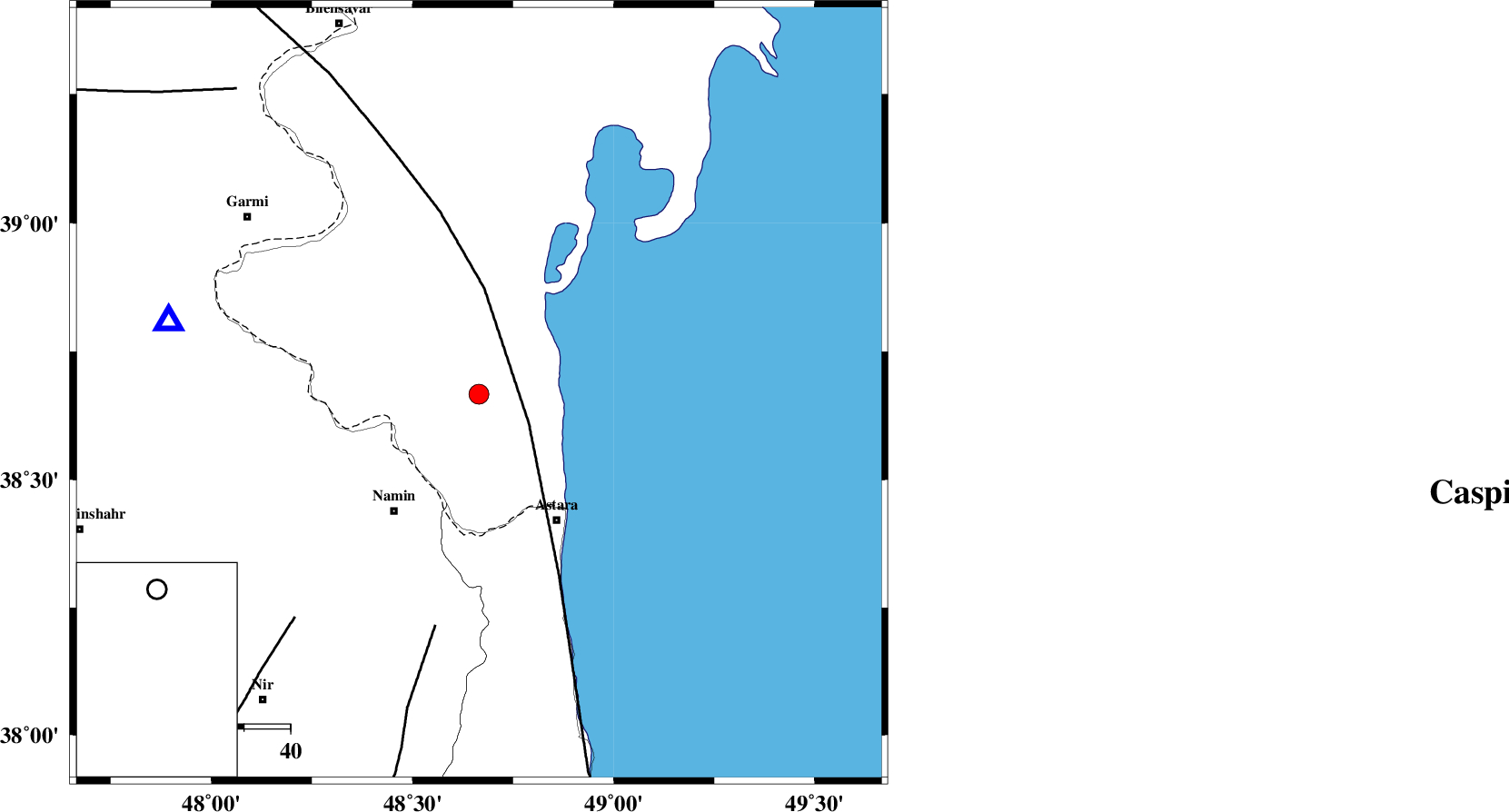
| Location | Lat:38.667 Lon: 48.665 |
| Region | Azerbaijan, 32 km North-West of Astara |
Nearest Cities |
|
| 26 km North East of Anbaran, Ardebil Province | |
| 30 km North East of Lurun, Ardebil Province | |
| 31 km North East of Khaneh zeinian, Ardebil Province | |
| 31 km North East of Namin, Ardebil Province | |
| 32 km North of Kiladeh, Gilan Province | |
| Depth | 7 km |
| Agency | |
Faults within 150 km: |
|
| TALESH_F (Length: 258 km) , Distance to epicenter: 13 km | |
| SANGAVAR_F (Length: 61 km) , Distance to epicenter: 51 km | |
| BOZQUSH (Length: 70 km) , Distance to epicenter: 63 km | |
| Number of Phases | 7 |
| RMS | 0.1 |
| Number of Stations | 5 |
| Error in Latitude | >4.5 km |
| Error in Longitude | 4.7 km |
| Error in Depth | 2.1 km |
Download waveform in seisan format
to download seisan software Click here
to access information about IIEES stations Click here
Amplitude | ||||||||
| UID | Agency | Station | Component | Amplitude | Period | Arrival Time | Proccessing Time | Signal Clip |
| 138817 | IIEES | GRMI | E | 999 | 0.2 | 2018-11-30 17:03:21 | 2018-12-01 07:07:00 | n |
| 138818 | IIEES | GIDE | N | 118.3 | 0.31 | 2018-11-30 17:04:01 | 2018-12-01 07:07:00 | n |
Phase | ||||||||||||
| Agency | Station | Component | Phase Type | Phase Quality | First Motion | Observed Arrival Time | Time Residual | Loc. Flag | Input Weight | Distance | Azimuth | |
| IIEES | GRMI | Z | Pg | E | 2018-11-30 17:03:11 | -0.01 | y | 68.9 | 283 | |||
| IIEES | GRMI | N | Sg | E | 2018-11-30 17:03:20 | -0.02 | y | 68.9 | 283 | |||
| IIEES | GIDE | Z | Pn | E | 2018-11-30 17:03:33 | -2.14 | n | 4 | 222 | 150 | ||
| IIEES | ZNJK | Z | Pn | E | 2018-11-30 17:03:35 | -0.09 | y | 222 | 180 | |||
| IIEES | MAKU | Z | Pn | E | 2018-11-30 17:03:52 | 0.07 | y | 353 | 284 | |||
| IIEES | MAKU | N | S | E | 2018-11-30 17:04:30 | -0.05 | y | 353 | 284 | |||
| IIEES | SRSL | Z | Pn | E | 2018-11-30 17:03:57 | 0.13 | y | 395 | 227 | |||